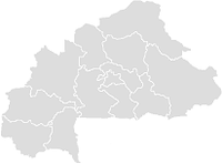
Lankoué — Status: commune rurale Region: Boucle du Mouhoun Provinz: Sourou Fläche: Einwohne … Deutsch Wikipedia
Lankoue — Lankoué Lankoué est un département du Burkina Faso situé dans la province Sourou et dans la région Boucle du Mouhoun. Population : 15 458 habitants. Villes Lankoué (4 968 habitants) (Chef lieu) Gourbala (1 744 habitants) Gourbassa (1 162… … Wikipédia en Français
Lankoué — 13°15′N 2°35′W / 13.25, 2.583 Lankoué est un département du Burkina Faso situé dans la … Wikipédia en Français
Lankoué (département) — Lankoué Lankoué est un département du Burkina Faso situé dans la province Sourou et dans la région Boucle du Mouhoun. Population : 15 458 habitants. Villes Lankoué (4 968 habitants) (Chef lieu) Gourbala (1 744 habitants) Gourbassa (1 162… … Wikipédia en Français
Lankoue Department — Infobox Settlement name =Lankoue settlement type =Department official name = other name = native name = nickname = motto = imagesize = image caption = flag size = image seal size = image shield = shield size = image blank emblem = blank emblem… … Wikipedia
Lankoe (département) — Lankoué Lankoué est un département du Burkina Faso situé dans la province Sourou et dans la région Boucle du Mouhoun. Population : 15 458 habitants. Villes Lankoué (4 968 habitants) (Chef lieu) Gourbala (1 744 habitants) Gourbassa (1 162… … Wikipédia en Français
BF-SOR — Sourou Basisdaten Region: Boucle du Mouhoun Hauptstadt: Tougan Departements: 8 Hochkommissar … Deutsch Wikipedia
Lanfiera — Lanfiéra Status: commune rurale Region: Boucle du Mouhoun Provinz: Sourou Fläche: Einwohner: 18.839 … Deutsch Wikipedia
Toeni — Toéni Status: commune rurale Region: Boucle du Mouhoun Provinz: Sourou Fläche: Einwohner: 30.183 … Deutsch Wikipedia
Departements du Burkina Faso — Départements du Burkina Faso Carte du Burkina Faso indiquant sa subdivision en départements Chaque province du Burkina Faso est subdivisée en départements. Les départements sont généralement désignés par le nom de leur ville principale. La… … Wikipédia en Français

