- Malimono
-
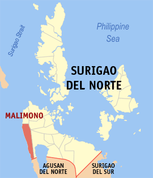
Municipality of Malimono Lage von Malimono in der Provinz Surigao del Norte 
Basisdaten Bezirk: Caraga Provinz: Surigao del Norte Barangays: 14 Distrikt: 2. Distrikt von Surigao del Norte PSGC: 166715000 Einkommensklasse: 5. Einkommensklasse Haushalte: 2817 Zensus 1. Mai 2000Einwohnerzahl: 16.883 Zensus 1. August 2007Koordinaten: 9° 37′ N, 125° 24′ O9.6166666666667125.4Koordinaten: 9° 37′ N, 125° 24′ O Postleitzahl: 8402 Offizielle Webpräsenz: www.malimono.gov.ph Geographische Lage auf den Philippinen 

Malimono Malimono ist eine philippinische Stadtgemeinde in der Provinz Surigao del Norte. Nach dem Zensus vom 1. Mai 2000 hat sie 14.597 Einwohner in 2817 Haushalten.
Baranggays
Malimono ist politisch in 14 Baranggays unterteilt.
- Bunyasan
- Cagtinae
- Can-aga
- Cansayong
- Cantapoy
- Cayawan
- Doro (Binocaran)
- Hanagdong
- Karihatag
- Masgad
- Pili
- San Isidro (Pob.)
- Tinago
- Villariza
Städte und Stadtgemeinden in der Provinz Surigao del NorteStädte: Surigao City
Stadtgemeinden: Alegria | Bacuag | Burgos | Claver | Dapa | Del Carmen | General Luna | Gigaquit | Mainit | Malimono | Pilar | Placer | San Benito | San Francisco | San Isidro | Santa Monica | Sison | Socorro | Tagana-an | Tubod
Wikimedia Foundation.
Schlagen Sie auch in anderen Wörterbüchern nach:
Malimono — Original name in latin Malimono Name in other language Malimono State code PH Continent/City Asia/Manila longitude 9.61806 latitude 125.40222 altitude 16 Population 0 Date 2011 07 31 … Cities with a population over 1000 database
Malimono, Surigao del Norte — Malimono is a 5th class municipality in the province of Surigao del Norte, Philippines. According to the 2000 census, it has a population of 14,597 people in 2,817 households. The Municipality of Malimono Mayor is Teodoro Sinaca Jr. while the… … Wikipedia
Surigao del Norte — Infobox Philippine province name = Surigao del Norte sealfile = Ph seal surigao del norte.png region = Caraga (Region XIII) capital = Surigao City founded = pop2000 = 374,465 pop2000rank = 27th smallest popden2000 = 193.3 popden2000rank = 47th… … Wikipedia
PH-SUN — Lage der Provinz Surigao del Norte (vor der Abspaltung von Dinagat Islands) Surigao del Norte ist eine Provinz im Nordosten der philippinischen Insel Mindanao. Sie gehört politisch dem Bezirk Caraga (Region XIII) an. Die Hauptstadt der Provinz… … Deutsch Wikipedia
Caraga — Infobox Philippine region name = Region XIII CARAGA map file = Ph locator region 13.png center = Butuan City population = 2,803,805 density km2 = 148.8 area km2 = 18,847.7 provinces = 5 cities = 3 municipalities = 70 barangays = 1,310 districts … Wikipedia
Mainit, Surigao del Norte — Municipality of Mainit Lungsod nan Mainit Bayan ng Mainit Seal … Wikipedia
Claver, Surigao del Norte — Claver redirects here. For the saint, see Peter Claver. Claver is a 2nd class municipality in the province of Surigao del Norte, Philippines. It is bounded to the north by the Pacific Ocean, to the west by the municipality of Gigaquit, and to the … Wikipedia
Dapa, Surigao del Norte — Dapa is a 5th class municipality in the province of Surigao del Norte, Philippines. According to the 2007 census, it has a population of 22,184 people. Most of municipality are situated within the island of Siargao.It is known to be as the Growth … Wikipedia
Del Carmen, Surigao del Norte — Del Carmen map Del Carmen is a 5th class municipality within the island of Siargao, in the province of Surigao del Norte, Philippines. According to the 2000 census, it has a population of 13,558 people in 2,598 households … Wikipedia
List of cities and municipalities in the Philippines — This is a list of cities and municipalities in the Philippines arranged by province and in alphabetical order. As of 2006, there are 118 cities and 1509 municipalities.As of September 4, 2007, there are 136 cities, 1,495 municipalities, 81… … Wikipedia
Malimono

18+
© Academic, 2000-2026
- Kontaktieren Sie uns: Unterstützung, Werbung
Wörterbücher Export, schritte mit PHP, Joomla, Drupal, WordPress, MODx.