Monte Prelà

Monte Prelà

f1

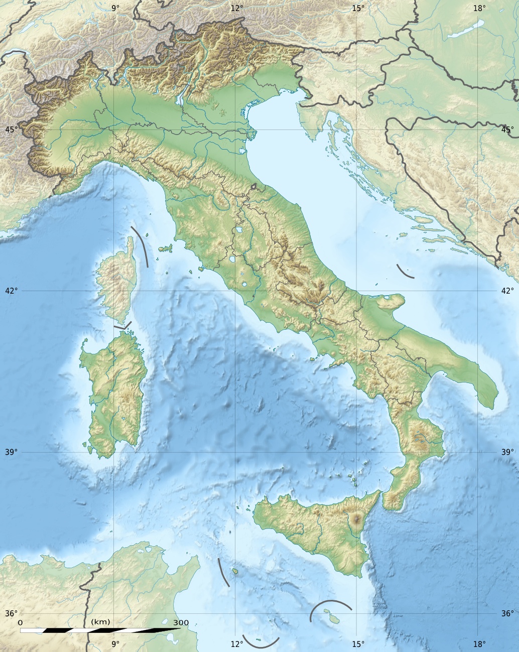
Monte Prelà
Höhe 1.406 m s.l.m.
Lage Provinz Genua, Italien
Gebirge Ligurischer Apennin
Geographische Lage 44° 31′ 0″ N, 9° 10′ 0″ O44.5166666666679.16666666666671406Koordinaten: 44° 31′ 0″ N, 9° 10′ 0″ O
Monte Prelà (Italien)
Monte Prelà

Der Monte Prelà ist ein Berg des Ligurischen Apennin in Italien. Sein Gipfel befindet sich in 1406 Metern Höhe über dem Meeresniveau. Der Berg liegt auf dem Territorium der Gemeinde Torriglia in der Provinz Genua. Nördlich vom Monte Prelà befindet sich der Monte Antola.

Am Monte Prelà entspringen die beiden Flüsse Scrivia und Trebbia, beides rechte Zuflüsse des Po.


Wikimedia Foundation.

Игры ⚽ Нужен реферат?

Schlagen Sie auch in anderen Wörterbüchern nach:

  • Monte Prelà — Elevation 1,407 m (4,616 ft) Location Location …   Wikipedia

  • Monte Maggiorasca — Photo of winter 2005 Elevation 1,799 m (5,902 ft) …   Wikipedia

  • Monte Antola — Elevation 1,597 m (5,240 ft) Location …   Wikipedia

  • Monte Bano — Monte Bano …   Wikipedia

  • Monte Beigua — The peak of Mount Beigua Elevation 1,287 m (4,222 ft) …   Wikipedia

  • Monte Bignone — Elevation 1,299 m (4,262 ft) …   Wikipedia

  • Monte Buio — Monte Buio …   Wikipedia

  • Monte Carmo — Elevation 1,641 m (5,384 ft) [ …   Wikipedia

  • Monte Carmo di Loano — Monte Carmo di Loano …   Wikipedia

  • Monte Castello (Liguria) — Monte Castello Elevation 1,092 m (3,583 ft) Location Location …   Wikipedia

Share the article and excerpts

Direct link
Do a right-click on the link above
and select “Copy Link”