- Moreton Island
-
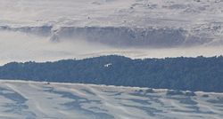
Die Moretoninsel ist eine Sandinsel an der Südostküste des australischen Bundesstaates Queensland. Sie liegt östlich von Brisbane und hat bei einer Größe von 168 Quadratkilometer eine maximale Nord-Süd-Ausdehnung von 38 km.
Der Moreton Island National Park macht 98% der Fläche der Insel aus. Auf ihr befindet sich die mit 278 m höchste Sanddüne der Welt in Küstennähe, die Mount Tempest.
Inhaltsverzeichnis
Lage
Moreton ist von einigen weiteren großen Sandinseln umgeben. Dies sind im Süden Stradbroke Island und North Stradbroke Island sowie im Norden Bribie Island und Fraser Island, die größte Sandinsel der Welt.
Geschichte
Die Insel wurde im Mai 1770 von James Cook entdeckt, der die Nordspitze des Eiland Kap Moreton nannte. Allerdings dachte Cook, dass es sich bei dem Kap um einen Teil des Festlands handle.
Im Zweiten Weltkrieg errichteten die Royal Australian Navy sowie die Australian Army eine Reihe von Verteidigungsanlagen auf Moreton. Ziel war es, den Hafen von Brisbane vor Flugzeugangriffen zu schützen.
Zwischen 1952 und 1962 befand sich in Tangalooma, auf der Westseite der Insel, Australiens einzige Walfangstation. Heute befindet sich in den alten Gebäuden der Station das Tangalooma Wild Dolphin Resort.
Tourismus
Heute ist die Moretoninsel touristisch gut erschlossen und bietet (Tages-)Urlaubern viele Unterhaltungsmöglichkeiten. So kann man tauchen, Delfine füttern oder Quad fahren. Wer nicht als Tagesgast mit der Schnellfähre aus Brisbane kommt kann auf einem Campingplatz übernachten.
Die touristischen Aktivitäten auf der Insel sollen zum 1. Juli 2007 besser kontrolliert werden. Dann tritt der Moreton Island Management Plan in Kraft. Mit ihm will die Regierung von Queensland die Natur besser schützen und den Tourismus in geordnete Bahnen lenken.[1]
Ölkatastrophe 2009
Im Jahr 2009 ereignete sich vor der Insel eine Ölkatastrophe. Ein Schiff verlor durch einen Sturm sowohl Chemikalien als auch Öl, das die Moretoninsel über dutzende Kilometer verschmutzte. Geschätzte 230 Tonnen Öl gelangten ins Meer und verklebten die Strände.[2]
Trivia
- Eine Salzwasserlagune auf der Insel wurde zeitweilig als Zuhause für eine Seekuh genutzt. Die junge Kuh, die auf den Namen Pig getauft wurde, sollte darin ihre natürlichen Instinkte trainieren, bevor sie in die Freiheit entlassen werden konnte.[3]
Quellen
- ↑ http://www.epa.qld.gov.au/parks_and_forests/managing_parks_and_forests/management_plans_and_strategies/moreton_island_management_plan/
- ↑ http://news.bbc.co.uk/2/hi/asia-pacific/7944724.stm
- ↑ http://news.bbc.co.uk/2/hi/not_in_website/syndication/monitoring/media_reports/2516161.stm
Weblinks
-27.0525153.39111111111Koordinaten: 27° 3′ S, 153° 23′ O
Wikimedia Foundation.


