Mount Majura

Mount Majura
BW

f1

Mount Majura
Höhe 888 m
Lage Canberra, Australien
Geographische Lage 35° 14′ 15″ S, 149° 10′ 50″ O-35.2375149.18055555556888Koordinaten: 35° 14′ 15″ S, 149° 10′ 50″ O
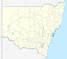
Mount Majura (New South Wales)
Mount Majura

Mount Majura ist ein 888 Meter hoher Hügel in Australien und die höchste Erhebung auf dem Gebiet der Hauptstadt Canberra. Er liegt in der Nähe des bekannteren Mount Ainslie und ist Teil des Canberra-Naturparks, am Rand des südöstlichen Vorortes Hackett. Auf dem Gipfel befindet sich eine Radarstation. Im Gegensatz zum Mount Ainslie gibt es keine öffentlich zugängliche Straße nach oben, diese ist meist gesperrt. Es gibt jedoch mehrere Wanderwege bis hinauf zum Gipfel. Der Hügel ist mit einheimischen australischen Bäumen bewachsen, hauptsächlich Eukalyptus.

Mount Majura (links) und Mount Ainslie (rechts)

Wikimedia Foundation.

Игры ⚽ Нужно решить контрольную?

Schlagen Sie auch in anderen Wörterbüchern nach:

  • Mount Majura — Top of Mount Majura Elevation 888 m (2,913 ft) …   Wikipedia

  • Mount Ainslie (Australian Capital Territory) — Mount Ainslie Mount Ainslie viewed from the Telstra Tower Elevation 842 m (2,762 ft) …   Wikipedia

  • Mount Ainslie — von der Südseite des Lake Burley Griffin aus gesehen, in der Bildmitte das Australian War M …   Deutsch Wikipedia

  • Watson, Australian Capital Territory — Infobox Australian Place | type = suburb name = Watson city = Canberra state = Australian Capital Territory lga = North Canberra ACTgov = Molonglo fedgov = Fraser est = 1960 postcode = 2602 pop = 4,111 (2001 census) propval = $370,000… …   Wikipedia

  • Geology of the Australian Capital Territory — Australia grew around three fused pieces of very ancient continental crust (cratons). The geology of the Australian Capital Territory includes rocks dating from the Ordovician around 480 million years ago, whilst most rocks are from the Silurian …   Wikipedia

  • Canberra-Naturpark — Eingang zum Reservat auf dem Red Hill Als Canberra Naturpark (engl. Canberra Nature Park) wird ein Verbund von 30 verschiedenen Naturschutzgebieten in der australischen Hauptstadt Canberra bezeichnet. Die Vegetation reicht von Wäldern über… …   Deutsch Wikipedia

  • Dickson, Australian Capital Territory — Dickson Canberra, Australian Capital Territory Population: 1,947 (2006 …   Wikipedia

  • Canberra Parish, Murray — Infobox Australian cadastral type = former parish name = Canberra Parish state = Australian Capital Territory imagesize = 180px caption = 1888 map of the parish lga = Yarrowlumla Shire (former) county = Murray land district = Queanbeyan division …   Wikipedia

  • Murray County, New South Wales — Map of all coordinates from Google Map of all coordinates from Bing Export all coordinates as KML …   Wikipedia

  • Canberra Central — Location of Canberra Central The District of Canberra Central is one of the 18 districts of the Australian Capital Territory used in land administration. It is subdivided into divisions (suburbs), sections and blocks. It is mentioned in the… …   Wikipedia

Share the article and excerpts

Direct link
Do a right-click on the link above
and select “Copy Link”