Nangou

Nangou
南郷町
Nangō-chō (eingemeindet)
Nangō (Miyagi) (Japan)
DEC
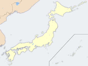
Geographische Lage in Japan
Region: Tōhoku
Präfektur: Miyagi
Koordinaten: 38° 29′ N, 141° 8′ O38.488375141.135458333337Koordinaten: 38° 29′ 18″ N, 141° 8′ 8″ O
Basisdaten
Eingemeindet am: 1. Jan. 2006
Eingemeindet in: Misato
Fläche: 39,52 km²
Einwohner: 6.707
(1. Dez. 2005)
Bevölkerungsdichte: 170 Einwohner je km²
Gemeindeschlüssel: 04504-7
Symbole
Baum: Japanische Zelkove
Blume: Garten-Chrysantheme
Rathaus
Adresse: Nangō Town Hall
1 Aza Chūō, Kimatsuka
Nangō-chō, Tōda-gun
Miyagi 989-4205
Webadresse:

Nangō (jap. 南郷町, -chō) war eine Stadt im Tōda-gun in der japanischen Präfektur Miyagi.

Inhaltsverzeichnis

Geschichte

Das Mura Nangō (南郷村, -mura) wurde am 1. Juli 1954 zur Chō ernannt.

Am 1. Januar 2006 schloss sich Nangō mit der Chō Kogota (小牛田町, -chō) zur neuen Machi Misato (美里町, -machi) zusammen.

Verkehr

Städtepartnerschaften

Bildung

In Nangō befanden sich 1 Ober-, 1 Mittel- und 2 Grundschulen.

Söhne und Töchter der Stadt


Wikimedia Foundation.

Игры ⚽ Нужно решить контрольную?

Schlagen Sie auch in anderen Wörterbüchern nach:

  • Hachinohe, Aomori — Infobox City Japan Name= Hachinohe JapaneseName= 八戸市 Map Region= Tōhoku Prefecture= Aomori District= Area km2= 305.17 PopDate= April 30, 2008 Population= 245,921 Density km2= 806 Coords= LatitudeDegrees= 40 LatitudeMinutes= 30 LatitudeSeconds=… …   Wikipedia

  • Akagi (manga) — Infobox animanga/Header name = Akagi caption = Akagi Anime ja name = ja name trans = genre = Drama, Sports, GamblingInfobox animanga/Manga title = author = Nobuyuki Fukumoto publisher = flagicon|Japan Take Shobo demographic = Seinen magazine =… …   Wikipedia

  • Tajima, Fukushima — Tajima (田島町; machi) was a town located in Minamiaizu District, Fukushima, Japan. It is the largest town in the Minamiaizu district and in the summer holds the locally famous Gion Festival, not to be confused with the Tobata Gion Festival in… …   Wikipedia

  • Tateiwa, Fukushima — Tateiwa (舘岩村; mura) is a village located in Minamiaizu District, Fukushima, Japan. It is popular with city dwellers for its plentiful hot springs and skiing/snowboarding.As of 2003, the village had an estimated population of 2,275 and a density… …   Wikipedia

  • Ina, Fukushima — Ina (伊南村; mura) is a village located in Minamiaizu District, Fukushima, Japan.As of 2003, the village has an estimated population of 1,812 and a density of 11.83 persons per km². The total area is 153.13 km².*On March 20, 2006, the municipalities …   Wikipedia

  • Sannohe District, Aomori — nihongo|Sannohe|三戸郡|Sannohe gun is a district located in Aomori Prefecture, Japan.As of 2003, the district has an estimated population of 87,570 and a density of 82.57 persons per km². The total area is 1,060.53 km². Towns and villages *Gonohe… …   Wikipedia

  • Yuichi Nakamura — This article is about the screen/stage actor and D Boys member. For the voice actor, see Yuichi Nakamura (voice actor). For the similarly named singer Yuichi Nakamaru, see KAT TUN. Yuichi Nakamura Born October 8, 1987 (1987 10 08) (age 24)… …   Wikipedia

  • List of mergers in Aomori Prefecture — The following is a list of mergers that occurred in the 2000s in Aomori Prefecture, Japan.(as of March 1, 2006)Mergers from April 1, 1999 to March 31, 2000Mergers from April 1, 2000 to March 31, 2001Mergers from April 1, 2001 to March 31,… …   Wikipedia

  • List of mergers in Fukushima Prefecture — The following is a list of mergers that occurred in the 2000s in Fukushima Prefecture, Japan.(as of January 1, 2007)Mergers from April 1, 1999 to March 31, 2000Mergers from April 1, 2000 to March 31, 2001Mergers from April 1, 2001 to March 31,… …   Wikipedia

  • Nangō (Miyagi) — Nangō chō (eingemeindet) 南郷町 …   Deutsch Wikipedia

Share the article and excerpts

Direct link
Do a right-click on the link above
and select “Copy Link”