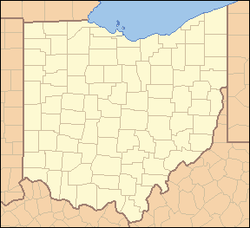
Rickenbacker International Airport

Rickenbacker International Airport
Flughafen Rickenbacker International (Ohio)
DEC
Kenndaten
IATA-Code LCK
ICAO-Code KLCK
Koordinaten
39° 48′ 50″ N, 82° 55′ 40″ W39.813786111111-82.927822222222227Koordinaten: 39° 48′ 50″ N, 82° 55′ 40″ W 227 m ü. MSL
Verkehrsanbindung
Entfernung vom Stadtzentrum
Straße London-Groveport Road (OH 317), I-270
Basisdaten
Eröffnung 1942
Betreiber Columbus Regional Airport Authority
Fläche
Luftfracht 113.717 t [1] (2006)
Flug-
bewegungen
98.842 [1] (2006)
Start- und Landebahnen
05R/23L 3.689 m × 61 m
05L/23R 3.638 m × 46 m Asphalt
06/24
(geschlossen)
989 m × 18 m Asphalt

Der 1942 gegründete Rickenbacker International Airport ist der zweitgrößte Flughafen von Columbus (Ohio) - nach dem Port Columbus International Airport.

Auf dem Rickenbacker International Airport findet nur gelegentlicher Passagierverkehr mit saisonalen Charterflügen statt, es gibt keine Passagierlinienflüge. Der größte Teil des Luftverkehrs wird durch die Allgemeine Luftfahrt und Militärflüge verursacht. Zudem ist der Flughafen bedeutend für den Frachtflugverkehr der Region um Columbus.

Geschichte

Der Flughafen wurde im Juni 1942 als Lockbourne Army Airfield (nach dem benachbarten Ort Lockbourne) eröffnet und bald darauf in Northeastern Training Center of the Army Air Corps umbenannt. 1948 wurde das Flugfeld in Lockbourne Air Force Base umbenannt, 1973 schließlich nach dem aus Columbus stammenden Kampfpiloten Edward Vernon Rickenbacker in Rickenbacker Air Force Base und 1980 in Rickenbacker Air National Guard Base.

1991 wurde die Basis zur Schließung vorgeschlagen, durch einen 1993 erstellten Vorschlag des Bundesstaates Ohio aber durch Umstationierungen weiter betrieben. Es folgte 1994 die Umbezeichnung in Rickenbacker Air National Guard Station. 2001 folgte die Grundsteinlegung für neue Einrichtungen der Militärflugbasis.

2003 verschmolz die vormalige Rickenbacker Port Authority mit den anderen Flughafenbetreibern der Region zur Columbus Regional Airport Authority.

Weblinks

Einzelnachweise

  1. a b ACI

Wikimedia Foundation.

Игры ⚽ Поможем написать курсовую

Schlagen Sie auch in anderen Wörterbüchern nach:

  • Rickenbacker International Airport — Infobox Airport name = Rickenbacker International Airport image width = 189 IATA = LCK ICAO = KLCK FAA = LCK type = Public owner = operator = Columbus Regional Airport Authority city served = Columbus, OH location = elevation f = 744 elevation m …   Wikipedia

  • Flughafen Rickenbacker International — Rickenbacker International Airport …   Deutsch Wikipedia

  • Port Columbus International Airport — Coordinates: 39°59′53″N 082°53′31″W / 39.99806°N 82.89194°W / 39.99806; 82.89194 …   Wikipedia

  • Miami International Airport — terminal …   Wikipedia

  • Pittsburgh International Airport — Infobox Airport name = Pittsburgh International Airport IATA = PIT ICAO = KPIT FAA = PIT type = Public / Military operator = Allegheny County Airport Authority city served = location = Findlay Township, Pennsylvania elevation f = 1,204 elevation… …   Wikipedia

  • O'Hare International Airport — ORD redirects here. For other uses, see Ord (disambiguation). Ohare redirects here. For people with that name, see O Hare (surname). Chicago O Hare International Airport USGS aerial image, 2011 …   Wikipedia

  • Raleigh-Durham International Airport — Durham Airport redirects here. For the UK airport, see Durham Tees Valley Airport. Raleigh Durham International Airport IATA: RDU – ICAO: KRDU – FAA …   Wikipedia

  • Mohammed V International Airport — Aéroport international Mohammed V مطار محمد الخامس الدولي Inside the main terminal IATA: CMN – …   Wikipedia

  • Minneapolis-Saint Paul International Airport — Infobox Airport name = Minneapolis Saint Paul International Airport image width = 175 image2 width = 150 caption2 = FAA Airport Diagram IATA = MSP ICAO = KMSP FAA = MSP type = Public owner = MAC city served = flagicon|United States Minneapolis… …   Wikipedia

  • Myrtle Beach International Airport — For the United States Air Force use of the facility before March 1993, see Myrtle Beach Air Force Base. Myrtle Beach International Airport IATA: MYR – ICAO: KMYR – FAA LID: MYR Summary Airport type …   Wikipedia

Share the article and excerpts

Direct link
Do a right-click on the link above
and select “Copy Link”