- Shire of South Gippsland
-
South Gippsland Shire 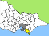
Lage South Gippsland Shire in Victoria Basisdaten Bundesstaat: Victoria Hauptort: Leongatha Fläche: 3.280 km² Einwohner: 27.440 (Juni 2006) Wards: 3 South Gippsland Shire ist ein lokales Verwaltungsgebiet (LGA) im australischen Bundesstaat Victoria. Das Gebiet ist 3.280 km² groß und hat etwa 27.000 Einwohner.
South Gippsland liegt an der Südküste Victorias und grenzt im Nordosten an das Cardinia Shire der Hauptstadt Melbourne. Das Gebiet schließt folgende Ortschaften ein: Bena, Buffalo, Dumbalk, Fish Creek, Foster, Koonwarra, Kongwak, Korumburra, Leongatha, Loch, Meeniyan, Mirboo North, Nyora, Poowong, Port Franklin, Port Welshpool, Sandy Point, Stony Creek, Tarwin Lower, Toora, Venus Bay, Walkerville, Waratah Bay, Welshpool und Yanakie. Der Sitz des City Councils befindet sich in der etwa 6.500 Einwohner zählenden Kleinstadt Leongatha in der Nordhälfte der LGA.
Die Südspitze von Wilson's Promontory, der sog. South Point, ist der südlichste Festlandspunkt von Victoria und damit des australischen Kontinents. Das kurz "The Prom" genannte Gebiet ist ein Nationalpark auf der in die Bass-Straße hineinragenden Halbinsel im Südosten des Shires, das für seine reiche Tierwelt bekannt ist.
Eine weitere Landschaftsattraktion von South Gippsland sind die Agnes Falls in der Nähe des Küstenorts Toora, mit 59 m die höchsten Wasserfälle im Bundesstaat.
Die hügelige Wiesenlandschaft des südlichen Gippslands, die die Region prägt, ist ideales Weideland, und so ist Milchwirtschaft die Haupteinnahmequelle im Shire. Nach eigenen Angaben gab es in Korumburra in den 1950ern die größte Butterfabrik der Südhalbkugel[1].
Von der Entdeckung 1872 bis in die Mitte des 20. Jahrhunderts wurde im Gebiet von Korumburra im Nordwesten auch Kohle abgebaut. Es waren die ersten profitablen Kohleminen Victorias. In Coal Creek befindet sich heute ein Bergbaumuseum[2].
Verwaltung
Der South Gippsland Shire Council hat neun Mitglieder, die von den Bewohnern der drei Wards gewählt werden. Jeder dieser drei Bezirke - Tarwin, Strzelecki und Coastal-Promontory - stellt drei Councillor. Aus dem Kreis der Councillor rekrutiert sich auch der Mayor (Bürgermeister) des Councils.
Quellen
- ↑ http://www.heritageaustralia.com.au/search.php?state=VIC®ion=77&view=349
- ↑ http://www.coalcreekvillage.com.au/history.htm
Weblinks
Ländliche Gebiete: Alpine | Ararat | Ballarat | Bass Coast | Baw Baw | Benalla | Buloke | Campaspe | Central Goldfields | Colac Otway | Corangamite | East Gippsland | Gannawarra | Glenelg | Golden Plains | Greater Bendigo | Greater Geelong | Greater Shepparton | Hepburn | Hindmarsh | Horsham | Indigo | Latrobe | Loddon | Macedon Ranges | Mansfield | Mildura | Mitchell | Moira | Moorabool | Mount Alexander | Moyne | Murrindindi | Northern Grampians | Pyrenees | Queenscliffe | South Gippsland | Southern Grampians | Strathbogie | Surf Coast | Swan Hill | Towong | Wangaratta | Warrnambool | Wellington | West Wimmera | Wodonga | Yarriambiack
Greater Melbourne: Banyule | Bayside | Boroondara | Brimbank | Cardinia | Casey | Darebin | Frankston | Glen Eira | Greater Dandenong | Hobsons Bay | Hume | Kingston | Knox | Manningham | Maroondah | Maribyrnong | Melbourne | Melton | Monash | Moonee Valley | Moreland | Mornington Peninsula | Nillumbik | Port Phillip | Stonnington | Whitehorse | Whittlesea | Wyndham | Yarra | Yarra Ranges

Wikimedia Foundation.