- Shire of Southern Grampians
-
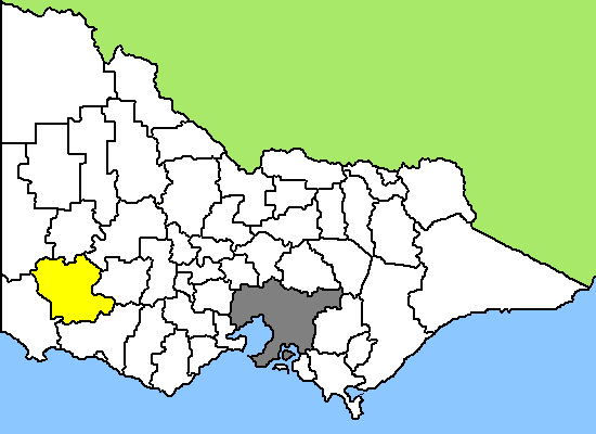
Southern Grampians Shire 
Lage des Southern Grampians Shire in Victoria Basisdaten Bundesstaat: Victoria Hauptort: Hamilton Fläche: 6.652 km² Einwohner: 16.831 (Juni 2006) Das Southern Grampians Shire ist ein lokales Verwaltungsgebiet (LGA) im australischen Bundesstaat Victoria. Das Gebiet ist 6.652 km² groß und hat etwa 17.000 Einwohner. Southern Grampians liegt im Südwesten Victorias etwa 270 km westlich der Hauptstadt Melbourne und schließt folgende Ortschaften ein: Balmoral, Cavendish, Coleraine, Wannon, Hamilton, Dunkeld, Branxholme, Byaduk und Penshurst. Der Sitz des City Councils befindet sich in Hamilton in der Südhälfte der LGA, die etwa 8.700 Einwohner hat.
Die Stadt nennt sich "Wool Capital of the World", die Welthauptstadt der Wolle. Etwa sechs Millionen Schafe gibt es in einem Umkreis von 80 km um Hamilton und die Wollproduktion hier macht 15 % des Gesamtertrags von ganz Australien aus. Wahrzeichen der Stadt ist ein aus fünf Teilen in Form von Wollballen bestehendes Gebäude, genannt The Big Wool Bales, das ein Wollmuseum enthält.
In Hamilton wurde 1936 Ansett Airways gegründet, das bis zur Jahrtausendwende eine der beiden führenden Fluglinien Australiens gewesen war, dann aber bankrott ging.
Den Namen hat das Shire von der Bergkette der Grampians, die nordwestlich des Shires verlaufen. Im Norden befindet sich der Grampians-Nationalpark und im Westen die Weinregion Coonararra.
Verwaltung
Der Southern Grampians Shire Council hat sieben Mitglieder, die von den Bewohnern der LGA gewählt werden. Southern Grampians ist nicht in Bezirke untergliedert. Aus dem Kreis der Councillor rekrutiert sich auch der Mayor (Bürgermeister) des Councils.
Weblinks
Ländliche Gebiete: Alpine | Ararat | Ballarat | Bass Coast | Baw Baw | Benalla | Buloke | Campaspe | Central Goldfields | Colac Otway | Corangamite | East Gippsland | Gannawarra | Glenelg | Golden Plains | Greater Bendigo | Greater Geelong | Greater Shepparton | Hepburn | Hindmarsh | Horsham | Indigo | Latrobe | Loddon | Macedon Ranges | Mansfield | Mildura | Mitchell | Moira | Moorabool | Mount Alexander | Moyne | Murrindindi | Northern Grampians | Pyrenees | Queenscliffe | South Gippsland | Southern Grampians | Strathbogie | Surf Coast | Swan Hill | Towong | Wangaratta | Warrnambool | Wellington | West Wimmera | Wodonga | Yarriambiack
Greater Melbourne: Banyule | Bayside | Boroondara | Brimbank | Cardinia | Casey | Darebin | Frankston | Glen Eira | Greater Dandenong | Hobsons Bay | Hume | Kingston | Knox | Manningham | Maroondah | Maribyrnong | Melbourne | Melton | Monash | Moonee Valley | Moreland | Mornington Peninsula | Nillumbik | Port Phillip | Stonnington | Whitehorse | Whittlesea | Wyndham | Yarra | Yarra Ranges
Wikimedia Foundation.