- Whiteriver
-
Whiteriver 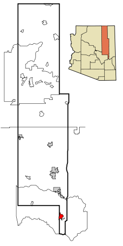 Lage im County und in Arizona
Basisdaten Staat: Vereinigte Staaten Bundesstaat: Arizona County: Koordinaten: 33° 50′ N, 109° 58′ W33.833055555556-109.974444444441599Koordinaten: 33° 50′ N, 109° 58′ W Zeitzone: Mountain Standard Time (UTC−7) Einwohner: 5220 (Stand: 2000) Bevölkerungsdichte: 113,2 Einwohner je km² Fläche: 46,1 km² (ca. 18 mi²)
davon 46,1 km² (ca. 18 mi²) LandHöhe: 1599 m Postleitzahl: 85941 Vorwahl: +1 928 FIPS: 04-82530 GNIS-ID: 0013704 Whiteriver (Westliche Apachen Chʼílwozh) ist ein Census-designated place im Navajo County im US-Bundesstaat Arizona. Whiteriver hat 5220 Einwohner auf einer Fläche von 46,2 km².
Er liegt auf 1599 m. ü. M. in der Fort-Apache-Reservation im Süden des Countys und wird von der Arizona State Route 73 tangiert. Mit dem Whiteriver Airport verfügt Whiteriver über einen eigenen Flugplatz.
Bildung
Whiteriver liegt im Whiteriver Unified School District.
 Orte im Navajo County
Holbrook | Pinetop-Lakeside | Show Low | Snowflake | Taylor | Winslow | Chilchinbito | Cibecue | Dilkon | East Fork | First Mesa | Greasewood | Heber-Overgaard | Hotevilla-Bacavi | Jeddito | Kayenta | Keams Canyon | Kykotsmovi Village | McNary (auch im Apache County) | Oljato-Monument Valley | Pinon | Second Mesa | Shongopovi | Shonto | Whiteriver | Winslow West
Wikimedia Foundation.
Schlagen Sie auch in anderen Wörterbüchern nach:
Whiteriver — Lugar designado por el censo de los Estados Unidos … Wikipedia Español
Whiteriver — Whiteriver, AZ U.S. Census Designated Place in Arizona Population (2000): 5220 Housing Units (2000): 1330 Land area (2000): 17.818530 sq. miles (46.149780 sq. km) Water area (2000): 0.000000 sq. miles (0.000000 sq. km) Total area (2000):… … StarDict's U.S. Gazetteer Places
Whiteriver, AZ — U.S. Census Designated Place in Arizona Population (2000): 5220 Housing Units (2000): 1330 Land area (2000): 17.818530 sq. miles (46.149780 sq. km) Water area (2000): 0.000000 sq. miles (0.000000 sq. km) Total area (2000): 17.818530 sq. miles (46 … StarDict's U.S. Gazetteer Places
Whiteriver — Original name in latin Whiteriver Name in other language WTR, Whiteriver State code US Continent/City America/Phoenix longitude 33.83699 latitude 109.96427 altitude 1599 Population 4104 Date 2013 06 23 … Cities with a population over 1000 database
Whiteriver Unified School District — is a school district in Navajo County, Arizona, United States. The district serves parts of Navajo County, including the communities of Cibecue, East Fork, and Whiteriver. Contents 1 Schools 1.1 High schools 1 … Wikipedia
Whiteriver, Arizona — Infobox Settlement official name = Whiteriver, Arizona settlement type = CDP imagesize = image caption = image imagesize = image caption = image mapsize = 250px map caption = Location in Navajo County and the state of Arizona mapsize1 = map… … Wikipedia
WhiteRiver — White River 1. A river of northern Arkansas and southern Missouri flowing about 1,110 km (690 mi) generally southeast to the Mississippi River. 2. A river, about 257 km (160 mi) long, of northwest Colorado and eastern Utah flowing westward to the … Universalium
85941 — Whiteriver, Az (Miscellaneous » ZIP Codes) … Abbreviations dictionary
White River State Park — Designation State Park Location Indiana USA Nearest City Indianapolis, Indiana Area 250 acres Date of Establishment 1979 Governing Body [http://www.in.gov/whiteriver/about/admin.htm … Wikipedia
Navajo County, Arizona — Historic Navajo County Courthouse and Museum in Holbrook, Arizona … Wikipedia
Whiteriver


18+
© Academic, 2000-2024
- Kontaktieren Sie uns: Unterstützung, Werbung
Wörterbücher Export, schritte mit PHP, Joomla, Drupal, WordPress, MODx.