- Hotevilla-Bacavi
-
Hotevilla-Bacavi 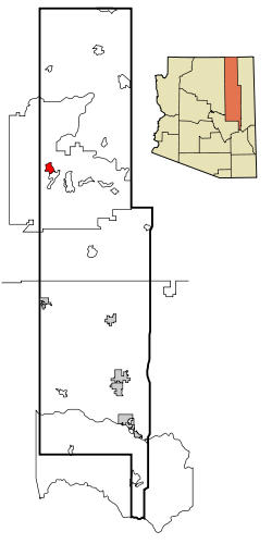 Lage im County und in Arizona
Basisdaten Staat: Vereinigte Staaten Bundesstaat: Arizona County: Koordinaten: 35° 55′ N, 110° 40′ W35.923055555556-110.6655555555611919Koordinaten: 35° 55′ N, 110° 40′ W Zeitzone: Mountain Standard Time (UTC−7) Einwohner: 767 (Stand: 2000) Bevölkerungsdichte: 24,9 Einwohner je km² Fläche: 30,8 km² (ca. 12 mi²)
davon 30,8 km² (ca. 12 mi²) LandHöhe: 11919 m FIPS: 04-33945 GNIS-ID: 1853160 Hotevilla-Bacavi (Hopi: Hotvela-Paaqavi, auch als Third Mesa bezeichnet) ist ein Census-designated place im Navajo County im US-Bundesstaat Arizona. Hotevilla-Bacavi hat 767 Einwohner auf einer Fläche von 30,8 km². Er liegt in der Hopi Reservation innerhalb der Navajo Nation.
Die Erstbesiedelung von Hotevilla erfolgte durch die Feindseligen, eine Gruppe von Hopibewohnern, die 1906 aus dem nahegelegenen Oraibi vertrieben wurden. Hintergrund waren ideologische Zwistigkeiten über den kulturellen Einfluss von weißen Siedlern, Soldaten und Missionaren, dem sich die Feindseligen widersetzten. Ein späterer Versuch der Reintegration führte zu einer weiteren Abspaltung und zur Gründung von Bacavi. Dieses schloss sich im weiteren Verlauf mit Hotevilla zur heutigen Siedlung zusammen.
Bildung
Hotevilla-Bacavi liegt im Cedar Unified School District. Die White Cone High School in First Mesa versorgt auch dieses Dorf.
 Orte im Navajo County
Holbrook | Pinetop-Lakeside | Show Low | Snowflake | Taylor | Winslow | Chilchinbito | Cibecue | Dilkon | East Fork | First Mesa | Greasewood | Heber-Overgaard | Hotevilla-Bacavi | Jeddito | Kayenta | Keams Canyon | Kykotsmovi Village | McNary (auch im Apache County) | Oljato-Monument Valley | Pinon | Second Mesa | Shongopovi | Shonto | Whiteriver | Winslow West
Wikimedia Foundation.
Schlagen Sie auch in anderen Wörterbüchern nach:
Hotevilla-Bacavi — Lugar designado por el censo de los Estados Unidos … Wikipedia Español
Hotevilla-Bacavi — Hotevilla Bacavi, AZ U.S. Census Designated Place in Arizona Population (2000): 767 Housing Units (2000): 331 Land area (2000): 11.904170 sq. miles (30.831657 sq. km) Water area (2000): 0.000000 sq. miles (0.000000 sq. km) Total area (2000):… … StarDict's U.S. Gazetteer Places
Hotevilla-Bacavi, AZ — U.S. Census Designated Place in Arizona Population (2000): 767 Housing Units (2000): 331 Land area (2000): 11.904170 sq. miles (30.831657 sq. km) Water area (2000): 0.000000 sq. miles (0.000000 sq. km) Total area (2000): 11.904170 sq. miles… … StarDict's U.S. Gazetteer Places
Hotevilla-Bacavi, Arizona — Infobox Settlement official name = Hotevilla Bacavi, Arizona settlement type = CDP imagesize = image caption = image imagesize = image caption = image mapsize = 250px map caption = Location in Navajo County and the state of Arizona mapsize1 = map … Wikipedia
Hotevilla — Bacavi, AZ U.S. Census Designated Place in Arizona Population (2000): 767 Housing Units (2000): 331 Land area (2000): 11.904170 sq. miles (30.831657 sq. km) Water area (2000): 0.000000 sq. miles (0.000000 sq. km) Total area (2000): 11.904170 sq.… … StarDict's U.S. Gazetteer Places
Hotevilla, AZ — Hotevilla Bacavi, AZ U.S. Census Designated Place in Arizona Population (2000): 767 Housing Units (2000): 331 Land area (2000): 11.904170 sq. miles (30.831657 sq. km) Water area (2000): 0.000000 sq. miles (0.000000 sq. km) Total area (2000):… … StarDict's U.S. Gazetteer Places
Oraibi, Arizona — Location in Navajo County and the state of Arizona Country United States … Wikipedia
Navajo County, Arizona — Historic Navajo County Courthouse and Museum in Holbrook, Arizona … Wikipedia
Charles Loloma — Born January 7, 1921(1921 01 07) Hotevilla Bacavi, Arizona Died June 9, 1991(1991 06 09) (aged 70) Nationality … Wikipedia
National Register of Historic Places listings in Navajo County, Arizona — Location of Navajo County in Arizona This is a list of the National Register of Historic Places listings in Navajo County, Arizona. It is intended to be a complete list of the properties and districts on the National Register of Historic Places… … Wikipedia
Hotevilla-Bacavi


18+
© Academic, 2000-2024
- Kontaktieren Sie uns: Unterstützung, Werbung
Wörterbücher Export, schritte mit PHP, Joomla, Drupal, WordPress, MODx.