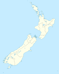
Kaingaroa

Kaingaroa

p1

Kaingaroa
Kaingaroa (Neuseeland)
Kaingaroa
Koordinaten 35° 2′ S, 173° 20′ O-35.026388888889173.32861111111Koordinaten: 35° 2′ S, 173° 20′ O
Region Northland
Distrikt Far North Distrikt
Kaingaroa Beach

Kaingaroa ist eine Siedlung im Far North Distrikt in der Region Northland auf der Nordinsel Neuseelands. Sie liegt am State Highway 10 zwischen Kareponia im Westen und Lake Ohia im Osten.[1] Nördlich des Ortes befindet sich der Naturhafen Ranghaunu Harbour.

Der Ort hat eine Grundschule, Kaingaroa School, für die Klassen 1-8 mit einem Decile rating von 3 und 2009 152 Schülern.[2]

Einzelnachweise

  1. [New Zealand Travel Atlas, Wise Maps Auckland. ISBN 0-908794-47-9]
  2. TKI

Wikimedia Foundation.

Игры ⚽ Поможем написать реферат

Schlagen Sie auch in anderen Wörterbüchern nach:

  • Kaingaroa — is the name of several places in New Zealand: *Kaingaroa Forest: a forest and settlement in the Bay of Plenty *Kaingaroa: a settlement in Northland *Kaingaroa: a fishing establishment in the Chatham Islands.… …   Wikipedia

  • Kaingaroa — Forêt de Kaingaroa Emplacement de la forêt sur une carte de l île du Nord La forêt de Kaingaroa est la plus grande forêt de l île du Nord de la Nouvelle Zélande, ainsi que la plus grande sapinière de l hémisphère sud. Elle est située au …   Wikipédia en Français

  • Kaingaroa Forest — is the largest forest in the North Island of New Zealand, and the largest plantation in the southern hemisphere. The privately owned forest covers 2900 km² in the inland East Cape and Bay of Plenty regions, and stretches south past the east coast …   Wikipedia

  • Kaingaroa State Forest — Forêt de Kaingaroa Emplacement de la forêt sur une carte de l île du Nord La forêt de Kaingaroa est la plus grande forêt de l île du Nord de la Nouvelle Zélande, ainsi que la plus grande sapinière de l hémisphère sud. Elle est située au …   Wikipédia en Français

  • Kaingaroa Forest — Lage des Kaingaroa Forest Der Kaingaroa Forest ist der größte Wald auf der Nordinsel Neuseelands und die größte forstliche Anpflanzung der Südhalbkugel. Der Wald bedeckt 2900 km² im Bereich des East Cape und der Bay of Plenty. Er erstreckt… …   Deutsch Wikipedia

  • Kaingaroa, Northland — Location map North Island label=Kaingaroa lat dir=S | lat deg=35 | lat min=2 lon dir=E | lon deg=173 | lon min=20 position=right width= 150 float=right caption=Kaingaroa is a locality in Northland, New Zealand. It lies on Highway 10 north east of …   Wikipedia

  • Forêt de Kaingaroa — Emplacement de la forêt sur une carte de l île du Nord La forêt de Kaingaroa est la plus grande forêt de l île du Nord de la Nouvelle Zélande, ainsi que la plus grande sapinière de l hémisphère sud. Elle est située au …   Wikipédia en Français

  • Taupo District Council — Infobox Taupo District name= Taupo District Council The Taupo District Council is a local council located in the Central North Island of New Zealand.AreaThe district stretches from the small town of Mangakino in the northwest to the Tongariro… …   Wikipedia

  • Murupara — …   Wikipedia

  • Chatham Islands — This article is about an island group of New Zealand. For other islands with this or similar names, see Chatham Island (disambiguation). Chatham Islands Native name: Rekohu, Wharekauri Topographical map of the Chatham Islands …   Wikipedia

Share the article and excerpts

Direct link
Do a right-click on the link above
and select “Copy Link”