Kwinella

Kwinella
Kwinella
13.393557462778-15.7984311925{{{elevation_save}}}Koordinaten: 13° 24′ N, 15° 48′ W
Karte: Gambia
marker
Region: Lower River
Distrikt: Kiang Central
Einwohner: 824 (2010)

EW3

Straßenszene in Kwinella

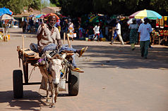
Kwinella (Schreibvariante: Kwinella Sansan Kono und Kwinella Nya Kunda) ist eine Ortschaft im westafrikanischen Staat Gambia.

Nach einer Berechnung für das Jahr 2010 leben dort etwa 824 Einwohner, das Ergebnis der letzten veröffentlichten Volkszählung von 1993 betrug 711.[1]

Geographie

Kwinella liegt in der Lower River Region im Distrikt Kiang Central. Der kleine Ort ist rund 29 Kilometer westlich von Soma und rund 12,5 Kilometer nördlich von Sankandi entfernt. Er liegt der South Bank Road, Gambias wichtigster Fernstraße. Nach Norden zweigt eine Straße nach Tendaba ab.

Kultur und Sehenswürdigkeiten

Zwischen Batelling und Kwinella ist ein historischer See als Kultstätte unter den Namen Mofadinka bekannt.[2] Weitere Kultstätten in Kwinella sind:

  • Namba Tinti: historischer Stätte
  • Mamkoto: historische Höhle (oder Kaverne)
  • Kumpa: historische Stätte
  • Kunyabali: historische Stätte
  • Bulangkeling Semani: religiöser Gebetsplatz
  • Mamakara Taba: historischer Baum

Einzelnachweise

  1. Kwinella in World Gazetteer, Zugriff Mai 2010
  2. Allen Meagher, Andrew Samuel, Baba Ceesay, National Council for the Arts and Culture (Gambia) et al: Historic sites of The Gambia : an official guide to the monuments and sites of The Gambia. National Council for the Arts and Culture, Banjul, The Gambia 1998, ISBN 9983-80-011-014 (formal falsche ISBN)

Wikimedia Foundation.

Игры ⚽ Поможем сделать НИР

Schlagen Sie auch in anderen Wörterbüchern nach:

  • Liste von Kultplätzen in Gambia — Die Liste von Kultplätzen in Gambia listet Kultstätten oder Kultplätze im westafrikanischen Staat Gambia auf. Die Auflistung wurde vom National Centre for Arts Culture 1998 veröffentlicht. Die Kultstätten sind näher klassifiziert als „heilig“… …   Deutsch Wikipedia

  • Wurokang — 13.378582234444 15.814723915833{{{elevation save}}}Koordinaten: 13° …   Deutsch Wikipedia

  • Süduferstraße — In der Nähe von Somita Zwischen Soma und Janjanbureh …   Deutsch Wikipedia

  • Tendaba — 13.438333333333 15.807222222222{{{elevation save}}}Koordinaten: 13°&# …   Deutsch Wikipedia

  • Maba Diakhou Ba — Maba Diakhou Bâ Maba Diakhou Bâ (1809 juillet 1867), né à Tavacaltou. Il est marabout du Rip (disciple d Oumar Tall) et devient maître du Saloum (Almamy). C est un descendant de la dynastie des Dényankobés, par la branche des familles… …   Wikipédia en Français

  • Maba Diakhou Bâ — (1809 juillet 1867), né à Tavacaltou. Il est marabout du Rip (disciple d Oumar Tall) et devient maître du Saloum (Almamy). C est un descendant de la dynastie des Dényankobés, par la branche des familles « Bâ » de la région du Badibou, d …   Wikipédia en Français

  • Bambaka — 13.405029865278 15.767473545556{{{elevation save}}}Koordinaten: 13°&# …   Deutsch Wikipedia

  • Batelling — 13.408208220278 15.842920845{{{elevation save}}}Koordinaten: 13° …   Deutsch Wikipedia

  • Kiang Central — Lage des Distrikts in der Lower River Region …   Deutsch Wikipedia

  • Madina (Gambia) — Madina 13.355723220556 15.761295627222{{{elevation save}}}Koordinaten …   Deutsch Wikipedia

Share the article and excerpts

Direct link
Do a right-click on the link above
and select “Copy Link”