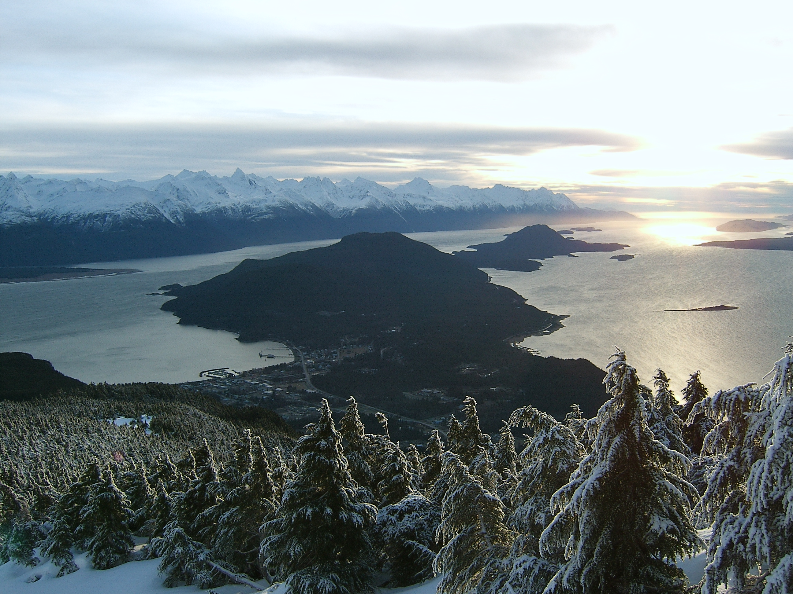
Chilkat Peninsula — A picture of the Chilkat Peninsula from the Takshanuk Mountains with Haines in the foreground. The Chilkat Peninsula is a peninsula in Lynn Canal, Southeast Alaska that divides the Chilkoot and Chilkat Inlets and divides the Chilkat and Chilkoot… … Wikipedia
Chilkat-Halbinsel — Blick von den Takshanuk Mountains auf die Chilkat Halbinsel, links im Vordergrund Haines, im Hintergrund die Boundary Ranges Gewäs … Deutsch Wikipedia
Chilkat Inlet — Looking out Chilkat Inlet from the Takshanuk Mountains. The tip of the Chilkat Peninsula can be seen in the background. Chilkat Inlet is an inlet in Lynn Canal in the Southeast region of the U.S. state of Alaska that includes the delta for the… … Wikipedia
Alaska Chilkat Bald Eagle Preserve — The Alaska Chilkat Bald Eagle Preserve is a state park and wildlife refuge in the U.S. state of Alaska near Haines. Established in 1982, the park covers 49,320 acres (199.6 km²), mainly along the Chilkat River, with sections along the… … Wikipedia
Haines, Alaska — Infobox Settlement official name = Haines, Alaska settlement type = City nickname = motto = image caption = Haines, as seen from the Chilkoot Inlet. imagesize = 250px image map caption = Location of Haines, Alaska mapsize = 250px mapsize1 = map… … Wikipedia
Davidson Glacier — Type Valley glacier Location Haines Borough, Alaska … Wikipedia
Taiya Inlet — from Chilkat Peninsula The Taiya Inlet is part of the upper Lynn Canal located in the U.S. state of Alaska. The Taiya Inlet is an estuary which lies in a deep valley, with Skagway, Alaska at its north end and the remainder of the Lynn Canal at… … Wikipedia
Chilkoot Inlet — is an inlet in the Southeast region of the U.S. state of Alaska, located on the eastern side of the Chilkat Peninsula in Lynn Canal. Chilkoot Inlet is the terminus of the Chilkoot River and its watershed, and also home to Lutak, Alaska.… … Wikipedia
Mount Ripinski — A picture of Mount Ripinski looking south. Elevation 3,600 ft (1,097 m) – r … Wikipedia
Alaskan mountains — ▪ mountains, United States Introduction three principal mountain groups the Brooks Range, Alaska Range, and Aleutian Range found in Alaska. The mountain ranges of Alaska give their state a rugged and beautiful terrain across its entire… … Universalium
 Blick von den Takshanuk Mountains auf die Chilkat-Halbinsel, links im Vordergrund Haines, im Hintergrund die Boundary Ranges.