Chilkat Range

Chilkat Range

p1f1

Chilkat Range
Höchster Gipfel Mount Young (1.737 m)
Lage Alaska (USA)
Teil der Alsek Ranges
Chilkat Range (Alaska)
Chilkat Range
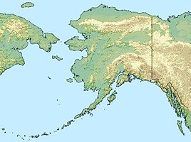
Koordinaten 58° 45′ N, 135° 30′ W58.75-135.51737Koordinaten: 58° 45′ N, 135° 30′ W

Die Chilkat Range ist ein etwa 40 km langer Gebirgszug der Alsek Ranges westlich von Juneau in Alaska.

Die Chilkat Range liegt an der Grenze zwischen dem Haines Borough und dem Glacier-Bay-Nationalpark und trennt das Chilkoot Inlet und den Lynn Canal vom Muir Inlet und der Glacier Bay. Im Norden reicht sie bis zum Klehini River und im Süden bis zur Icy Strait. Ein unbenanntes Eisfeld speist unter anderem den Davidson- und den Rainbow-Gletscher.

Die höchsten Berge sind der Mount Young mit 1.737 m und der Mount Case mit 1.676 m.

Das United States Geological Survey gab dem Gebirgszug 1879 in Anlehnung an einen Stamm der Tlingit-Indianer den Namen Chilkat Mountains. 1891 erfolgte die Umbenennung in Chilkat Range.

Weblinks


Wikimedia Foundation.

Игры ⚽ Нужен реферат?

Schlagen Sie auch in anderen Wörterbüchern nach:

  • Chilkat Range — from south of Haines The Chilkat Range is a mountain range in Haines Borough and the Hoonah Angoon Census Area in the U.S. state of Alaska,[1] west of the city of Juneau. The Chilkat Mountains are one of the prin …   Wikipedia

  • Chilkat Range — Sp Čilkato kalnãgūbris Ap Chilkat Range L JAV (Aliaska) …   Pasaulio vietovardžiai. Internetinė duomenų bazė

  • Chilkat — steht für: Chilkat River, einen Fluss in Alaska und British Columbia Chilkat Halbinsel, eine Halbinsel in Alaska Chilkat Inlet, eine Bucht in Alaska Chilkat Range, einen Gebirgszug in Alaska Alaska Chilkat Bald Eagle Preserve, ein Schutzgebiet in …   Deutsch Wikipedia

  • Chilkat Mountains — Die Chilkat Range ist ein etwa 40 km langer Gebirgszug der Alsek Ranges westlich von Juneau in Alaska. Die Chilkat Range liegt an der Grenze zwischen dem Haines Borough und dem Glacier Bay Nationalpark und trennt das Chilkoot Inlet und den Lynn… …   Deutsch Wikipedia

  • Chilkat River — A view up the Chilkat River valley from the Takshanuk Mountains. The Chilkat River is a river in British Columbia and southeastern Alaska that flows southward from the Coast Range to the Chilkat Inlet and ultimately Lynn Canal. It is about 80… …   Wikipedia

  • Alaskan mountains — ▪ mountains, United States Introduction       three principal mountain groups the Brooks Range, Alaska Range, and Aleutian Range found in Alaska.  The mountain ranges of Alaska give their state a rugged and beautiful terrain across its entire… …   Universalium

  • Klehini River — Der Klehini River in der Nähe des Haines HighwaysVorlage:Infobox Fluss/KARTE fehlt Da …   Deutsch Wikipedia

  • Davidson Glacier — Type Valley glacier Location Haines Borough, Alaska …   Wikipedia

  • Klehini River — The Klehini River is approximately 36 miles long (58 km) from its source in British Columbia to its mouth at the Chilkat River, of which it is the largest tributary. The Klehini River is renowned for its salmon runs, its biannual congregation of… …   Wikipedia

  • Takhinsha Mountains — The Takhinsha Mountains are a mountain range in Haines Borough and the Hoonah Angoon Census Area in the U.S. state of Alaska, [gnis|1415171] in the southeastern part of the state. They extend 40 km (25 mi) west northwest from the northern end of… …   Wikipedia

Share the article and excerpts

Direct link
Do a right-click on the link above
and select “Copy Link”