Sundoro

Sundoro
Sundoro
Sundoro.jpg
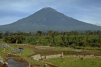
Höhe 3.136 m
Lage Java, Indonesien
Geographische Lage 7° 18′ 0″ S, 109° 59′ 46″ O-7.3109.996111111113136Koordinaten: 7° 18′ 0″ S, 109° 59′ 46″ O
Sundoro (Java)
Sundoro
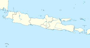
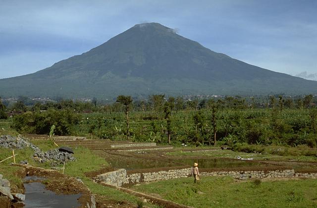
Typ Stratovulkan
Letzte Eruption 1971

Der Sundoro oder Sindoro ist ein aktiver Stratovulkan in Zentraljava, Indonesien. Der ausgesprochen symmetrische Bergkegel steht in unmittelbarer Nachbarschaft zum Sumbing.

Nördlich des Sundoro entspringt der Fluss Progo.

Weblinks

 Commons: Mount Sundoro – Sammlung von Bildern, Videos und Audiodateien

Wikimedia Foundation.

Игры ⚽ Нужен реферат?

Schlagen Sie auch in anderen Wörterbüchern nach:

  • Sundoro — Géographie Altitude 3 136 m Massif Île de Java Coordonnées …   Wikipédia en Français

  • Mount Sundoro — Mount Sindara Elevation 3,136 m (10,289 ft) [1] …   Wikipedia

  • Temanggung — 7°18′0″S 110°10′0″E / 7.3, 110.16667 Temanggung est une ville d Indonésie située dans la province de Java central …   Wikipédia en Français

  • Kabupaten de Temanggung — 7°18′S 110°10′E / 7.3, 110.167 …   Wikipédia en Français

  • Liste des volcans d'Indonésie — Carte d Indonésie indiquant les principaux volcans entrés en éruption depuis 1900. Cet article recense les volcans d Indonésie. Sommaire 1 Caractéristiques …   Wikipédia en Français

  • Liste von Vulkanen in Indonesien —  Karte mit allen Koordinaten: OSM, Google oder …   Deutsch Wikipedia

  • Progo — Der Progo in YogyakartaVorlage:Infobox Fluss/KARTE fehlt DatenVorlage:Infobo …   Deutsch Wikipedia

  • Borobudur — Infobox Historic building caption=Borobudur northwest view name=Borobudur map type=Java Topography map size=258 latitude= 7.608 longitude=110.204 location town=near Magelang, Central Java location country=Indonesia architect=Gunadharma client=… …   Wikipedia

  • Volcanoes of Java — Java is almost entirely of volcanic origin, and contains numerous volcanoes, 20 of which have been active in recent historical times. As is the case for many other Indonesian islands, volcanoes have played a vital role in the geological and human …   Wikipedia

  • Kedu Plain — Kedu PlainIs the high ground that lies between the volcanoes Mount Sumbing and Mount Sundoro to the west, and Mount Merbabu and Mount Merapi to the east on Central Java, Indonesia.It has been a significant location in Central Javanese history for …   Wikipedia

Share the article and excerpts

Direct link
Do a right-click on the link above
and select “Copy Link”