Sulligent

Sulligent
Sulligent
Lamar County Alabama Incorporated and Unincorporated areas Sulligent Highlighted.svg
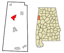
Lage im County und im Bundesstaat
Basisdaten
Staat: Vereinigte Staaten
Bundesstaat: Alabama
County:

Lamar County

Koordinaten: 33° 54′ N, 88° 8′ W33.8975-88.13166666666799Koordinaten: 33° 54′ N, 88° 8′ W
Zeitzone: Eastern Standard Time (UTC−5)
Einwohner: 2151 (Stand: 2000)
Bevölkerungsdichte: 106 Einwohner je km²
Fläche: 20,3 km² (ca. 8 mi²)
davon 20,3 km² (ca. 8 mi²) Land
Höhe: 99 m
Postleitzahl: 35586
Vorwahl: +1 205
FIPS: 01-73728
GNIS-ID: 0153600

Sulligent ist eine im 19. Jahrhundert gegründete City im Lamar County in Alabama in den Vereinigten Staaten.

Inhaltsverzeichnis

Geschichte

Die Stadt erhielt zuerst den Namen Elliott nach dem Chefingenieur der Kansas City-Memphis-Birmingham Railroad. Einen Monat später erhielt sie ihren heutigen Namen. Der Name der Stadt setzt sich aus der Vorsilbe des Eisenbahnsupervisor Sullivan und der Nachsilbe des Eisenbahnpassagierbeauftragten Sargeant zusammen. Die City wurde im Oktober 1887 inkorporiert. Die Produktion und Verarbeitung von Baumwolle war eine bedeutende Industrie. Das Hauptgeschäft in Sulligent Mitte der 1890er war Baumwolle mit über 2.500 entkörnten Bales pro Jahr, die per Eisenbahn weitertransportiert wurden. Seinerzeit war die Sulligent Cotton Oil Company als größte Cotton Gin unter einem Dach bekannt.

Bevölkerungsstatistik

Nach dem Census 2000 hat die Stadt eine Bevölkerung von 2,151 Einwohnern. [1] Im Jahr 2006 wurde die Einwohnerzahl vom United States Census Bureau auf 1985 geschätzt [2], ein Rückgang von 166 (-7.7%).

Weblinks

Einzelnachweise

  1. U.S. Census Bureau. Census 2000 Summary File 1
  2. U.S. Census Bureau. Population estimates (july 2006)

Wikimedia Foundation.

Игры ⚽ Нужна курсовая?

Schlagen Sie auch in anderen Wörterbüchern nach:

  • Sulligent — Sulligent, AL U.S. city in Alabama Population (2000): 2151 Housing Units (2000): 1029 Land area (2000): 7.852437 sq. miles (20.337717 sq. km) Water area (2000): 0.000000 sq. miles (0.000000 sq. km) Total area (2000): 7.852437 sq. miles (20.337717 …   StarDict's U.S. Gazetteer Places

  • Sulligent, AL — U.S. city in Alabama Population (2000): 2151 Housing Units (2000): 1029 Land area (2000): 7.852437 sq. miles (20.337717 sq. km) Water area (2000): 0.000000 sq. miles (0.000000 sq. km) Total area (2000): 7.852437 sq. miles (20.337717 sq. km) FIPS… …   StarDict's U.S. Gazetteer Places

  • Sulligent — Original name in latin Sulligent Name in other language State code US Continent/City America/Chicago longitude 33.90177 latitude 88.13448 altitude 100 Population 1927 Date 2011 05 14 …   Cities with a population over 1000 database

  • Sulligent (Alabama) — Sulligent Ciudad de los Estados Unidos …   Wikipedia Español

  • Sulligent, Alabama — Infobox Settlement official name = Sulligent, Alabama settlement type = City imagesize = image caption = image imagesize = image caption = image mapsize = 250px map caption = Location in Lamar County and the state of Alabama mapsize1 = map… …   Wikipedia

  • 35586 — Sulligent, Al (Miscellaneous » ZIP Codes) …   Abbreviations dictionary

  • Lamar County, Alabama — Infobox U.S. County county = Lamar County state = Alabama map size = 150 founded =1877 (as it is at present) seat = Vernon | largest city = Sulligent area total sq mi =605 area land sq mi =605 area water sq mi =1 area percentage =(0.10%) census… …   Wikipedia

  • Joe Cribbs — NFL player DateOfBirth=birth date and age|1958|1|5 Birthplace= Sulligent, Alabama DateofDeath= Position=Running back College=Auburn DraftedYear=1980 DraftedRound=2 / Pick 29 Stats=Y DatabaseFootball=CRIBBJOE01 PFR=CribJo00 years=1980 1983, 1985… …   Wikipedia

  • Alabama State Route 118 — Infobox road state=AL type=AL route=118 length mi=64 length ref= [ [http://colepages.com/routes101125.html Highway Route Info Routes 101 125 ] ] length round= established= direction a=West direction b=East starting terminus= junction= ending… …   Wikipedia

  • List of high schools in Alabama — This is a list of high schools in the state of Alabama, United States. Autauga County *Autaugaville School, Autaugaville *Billingsley High School, Billingsley *Prattville High School, Prattville *Marbury High School, Marbury Baldwin County… …   Wikipedia

Share the article and excerpts

Direct link
Do a right-click on the link above
and select “Copy Link”