Hovenweep National Monument
- Hovenweep National Monument
-
| Hovenweep National Monument |
|
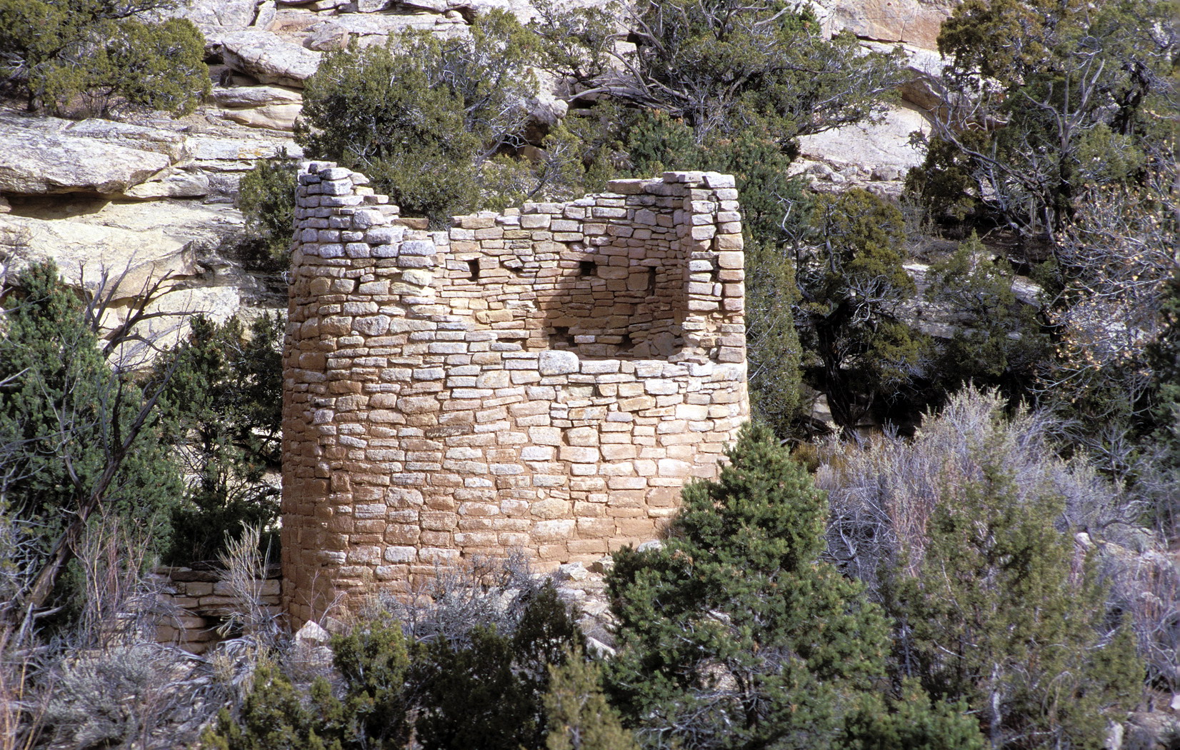
Cut throw castle |
|
|
| Lage: |
Utah, Vereinigte Staaten |
| Nächste Stadt: |
Cortez |
| Fläche: |
3,2 km² |
| Gründung: |
2. März 1923 |
| Besucher: |
26,662 (2005) |
|
|
|
Square Tower |
37.386799138889-109.07020568889
i3i6
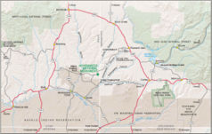
Das Hovenweep National Monument liegt auf der Grenze zwischen den Bundesstaaten Colorado und Utah westlich des Ortes Cortez. Es wurde am 2. März 1923 durch den Präsidenten Warren G. Harding eingerichtet. Das National Monument besteht aus sechs nicht zusammenhängenden Gebieten mit Ruinen der indianischen Ureinwohner. Holly Canyon, Backberry Canyon, Cutthroat castle und Goodman Point befinden sich dabei in Colorado, Cajon und Square Tower in Utah. Die Verwaltung befindet sich in der Nähe des Square Towers.
Geschichte
1854 entdeckte eine mormonische Expedition unter der Leitung von W.D. Huntigton die Ruinen, welche den zu diesem Zeitpunkt dort lebenden Indianern, den Ute und den Navajos, schon lange bekannt waren. Der Ausdruck Hovenweep kommt aus der Ute-Sprache und bedeutet so viel wie Ödes Tal. Der Ausdruck wurde 1874 von dem Maler und Fotografen William Henry Jackson übernommen.
Siehe auch
Weblinks
Kategorien:
- National Monument (Vereinigte Staaten)
- Geographie (Utah)
- Geographie (Colorado)
Wikimedia Foundation.
Schlagen Sie auch in anderen Wörterbüchern nach:
Hovenweep National Monument — Monument national Hovenweep Monument national Hovenweep Catégorie UICN V (paysage terrestre/marin protégé) Identifiant … Wikipédia en Français
Hovenweep National Monument — Infobox protected area name = Hovenweep National Monument iucn category = III caption = locator x = 73 locator y = 90 location = Montezuma County, Colorado San Juan County, Utah, USA nearest city = Cortez, Colorado, Blanding, Utah lat degrees =… … Wikipedia
Hovenweep National Monument — National monument, southwestern Colorado and southeastern Utah, U.S. Established in 1923 and covering 785 acres (318 hectares), it consists of six groups of pre Columbian Indian ruins, whose towers are excellent examples of Pueblo Indian… … Universalium
Hovenweep National Monument — Monumento nacional entre el sudoeste del estado de Colorado y el sur del estado de Utah en EE.UU. Fue creado en 1923 y ocupa una superficie de 318 ha (785 acres). Consta de seis grupos de ruinas indias de la época precolombina, cuyas torres son… … Enciclopedia Universal
Hovenweep National Monument — geographical name site SE Utah & SW Colorado of prehistoric pueblos & cliff dwellings … New Collegiate Dictionary
Hovenweep National Monument — Utah … Bryson’s dictionary for writers and editors
National Monument — Der Devils Tower war das erste Nationalmonument National Monument heißen in den Vereinigten Staaten durch die Bundesregierung ausgewiesene Schutzgebiete oder Gedenkstätten, die überwiegend vom National Park Service, einer dem Innenministerium… … Deutsch Wikipedia
Canyons of the Ancients National Monument — Monument national de Canyons of the Ancients Catégorie UICN III (monument naturel) Pays États Unis État … Wikipédia en Français
Chiricahua National Monument — Monument national Chiricahua Catégorie UICN V (paysage terrestre/marin protégé) Identifiant 1039 Pays … Wikipédia en Français
Ocmulgee National Monument — Monument national Ocmulgee Monument national Ocmulgee Catégorie UICN V (paysage terrestre/marin protégé) Identifiant 225 … Wikipédia en Français
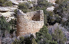

 Square Tower
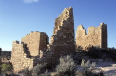 37.386799138889-109.07020568889Koordinaten: 37° 23′ 12″ N, 109° 4′ 13″ W
 Commons: Hovenweep National Monument – Sammlung von Bildern, Videos und AudiodateienKategorien: