Arapahoe County Airport

Arapahoe County Airport
Centennial Airport
Flughafen Centennial (Colorado)
DEC
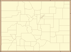
Kenndaten
IATA-Code APA
ICAO-Code KAPA
Koordinaten
39° 34′ 12″ N, 104° 50′ 57″ W39.570127777778-104.849294444441793Koordinaten: 39° 34′ 12″ N, 104° 50′ 57″ W 1.793 m ü. MSL
Verkehrsanbindung
Entfernung vom Stadtzentrum 30 km südöstlich von Denver
Straße I-25/CO 470
Basisdaten
Eröffnung Mai 1967
Fläche
Start- und Landebahnen
10/28 1.463 m × 23 m Asphalt
17R/35L 2.135 m × 23 m Asphalt
17L/35R 3.049 m × 30 m Asphalt

Der Centennial Airport ist der Kreisflughafen von Arapahoe County, Colorado, im Umland von Denver. Es handelt sich um einen sehr stark frequentierten Flughafen der Allgemeinen Luftfahrt (General Aviation) von einiger regionaler Bedeutung. Neben einem Kontrollturm mit den zugehörigen Einrichtungen der Flugsicherung bestehen drei Runways - 17/35 Left und Right, sowie 10/28. Zusätzlich finden sich einige Flugschulen, Vereine, Charterer und Wartungseinrichtungen für Flugzeuge.

Der ursprüngliche Name des Flughafens war Arapahoe County Airport. Er liegt außerhalb, aber unmittelbar südlich der Stadt Centennial, ist aber nicht nach der erst im Jahre 2001 ins Leben gerufenen Kommune genannt.

Weblinks


Kontrollturm

Wikimedia Foundation.

Игры ⚽ Нужен реферат?

Schlagen Sie auch in anderen Wörterbüchern nach:

  • Gunnison County Airport — Comté de Gunnison Pour les articles homonymes, voir Gunnison. Le comté de Gunnison est un comté du Colorado. Son siège est la ville de Gunnison. Le comté de Gunnison posséde un aéroport : le Gunnison County Airport (code AITA : GUC).… …   Wikipédia en Français

  • Arapahoe, North Carolina — Arapahoe is a town in Pamlico County, North Carolina, United States. As of the 2004 census, the town population was 434. Arapahoe shares many of its roles and duties with Minnesott Beach, North Carolina. It is part of the New Bern, North Carolina …   Wikipedia

  • Centennial Airport — Infobox Airport name = Centennial Airport IATA = APA ICAO = KAPA type = Public owner = Arapahoe County Public Airport Authority location = Centennial, Colorado elevation f = 5,883 elevation m = 1,793 coordinates =… …   Wikipedia

  • Centennial Airport — Centennial Airport …   Deutsch Wikipedia

  • Adams County, Colorado — Infobox U.S. County county = Adams County state = Colorado map size = 250 founded date = April 15 founded year = 1901 seat wl = Brighton largest city wl = Thornton area total sq mi =1182 area land sq mi =1176 area water sq mi =6 area percentage …   Wikipedia

  • Jefferson County, Colorado — Location in the state of Colorado …   Wikipedia

  • Denver County — Denver Spitzname: Mile High City Skyline Denver …   Deutsch Wikipedia

  • Denver International Airport — This article is about the current airport opened since 1995. For the airport previously serving Denver, Colorado, see Stapleton International Airport. Denver International Airport …   Wikipedia

  • Dolores County, Colorado — Location in the state of Colorado …   Wikipedia

  • Washington County (Colorado) — Verwaltung US Bundesstaat: Colorado Verwaltungssitz: Akron Gründung: 1877 Demographie Einwohner: 4926  ( …   Deutsch Wikipedia

Share the article and excerpts

Direct link
Do a right-click on the link above
and select “Copy Link”