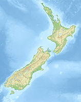
Mount Haast

Mount Haast

f1

Mount Haast
Höhe 3.140 m
Lage Neuseeland
Gebirge Neuseeländische Alpen
Geographische Lage 42° 19′ 0″ S, 172° 5′ 0″ O-42.316666666667172.083333333333140Koordinaten: 42° 19′ 0″ S, 172° 5′ 0″ O
Mount Haast (Neuseeland)
Mount Haast
Erstbesteigung 1907 durch Graham und Newton

Der Mount Haast ist ein Berg im Mount-Cook-Nationalpark auf der Südinsel Neuseelands. Der Berg ist 3140 m hoch und besitzt drei Gipfel, High Peak mit 3140 m, Middle Peak mit 3085 m und West Peak mit 3081 m Höhe.

Der Berg wurde nach dem deutschen Geologen Julius von Haast benannt.

Er wurde erstmals im Jahre 1907 von Graham und Newton über die heutige Standardroute bestiegen. Der Berg kann am besten von Mount Cook Village oder Franz Josef Village aus in der warmen Jahreszeit von Januar bis Dezember erreicht werden. Der Aufstieg selbst erfolgt über auf mehreren Routen über Felsen, Eis und Schnee vom Süden über die Plateau-Hütte oder vom Westen über die Pionier-Hütte.

Quellen


Wikimedia Foundation.

Игры ⚽ Поможем сделать НИР

Schlagen Sie auch in anderen Wörterbüchern nach:

  • Haast River — Vorlage:Infobox Fluss/KARTE fehlt DatenVorlage:Infobox Fluss/GKZ fehlt …   Deutsch Wikipedia

  • Haast Aerodrome — IATA: none – ICAO: NZHT Summary Airport type Private Operator Heliventures Ltd Location Haast, New Zealand …   Wikipedia

  • Mount Aspiring National Park — IUCN Category II (National Park) …   Wikipedia

  • Mount Aspiring / Tititea — Mount Aspiring/Tititea Elevation 3,033 m (9,951 ft) …   Wikipedia

  • Mount Tyndall (Tasmania) — Mount Tyndall Elevation 1,179 m (3,868 ft) Location Location …   Wikipedia

  • Haast Pass — Infobox Mountain Pass Name = Haast Pass Photo = NZ Haast P.png Caption = Location of Haast Pass Elevation = Location = NZL Range = Southern Alps Coordinates = Topographic Traversed by = State Highway 6Haast Pass is a mountain pass in the Southern …   Wikipedia

  • Mount Aspiring National Park — Park, southwestern South Island, New Zealand. Established in 1964, it has an area of 1,223 sq mi (3,167 sq km), including much of the Southern Alps and Mount Aspiring (9,932 ft [3,027 m]). Its southern boundary is Fiordland National Park. The… …   Universalium

  • Mount Aspiring National Park — Parc national du mont Aspiring Parc national du Mont Aspiring Catégorie II de la CMAP (Parc national) Ville proche Wanaka, Nouvelle Zélande …   Wikipédia en Français

  • Mount Franklin (Tasman) — For other places with this name, see Mount Franklin. Mount Franklin Elevation 2,340 m (7,677 ft) [1] Location …   Wikipedia

  • Mount Aspiring — Infobox Mountain Name = Mount Aspiring (Tititea) Photo = Mount Aspiring, Otago, New Zealand, 22 July 2005.jpg Caption = Elevation = 3,033 metres (9,950 ft) Location = South Island, New Zealand Range = Southern Alps Prominence = 2,475 m (8,120 ft) …   Wikipedia

Share the article and excerpts

Direct link
Do a right-click on the link above
and select “Copy Link”