Mount Guyot (North Carolina)
Schlagen Sie auch in anderen Wörterbüchern nach:
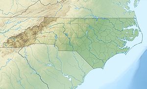
Mount Guyot — Karte mit allen verlinkten Seiten: OSM, Google oder … Deutsch Wikipedia
Mount Guyot (Great Smoky Mountains) — Mount Guyot Mt. Guyot, looking south from the Appalachian Trail Elevation 6,621 ft (2,018 … Wikipedia
Mount Guyot — Hills and mountains named Guyot, after geologist Arnold Guyot (1807–1884): Mount Guyot (Great Smoky Mountains), on the Tennessee/North Carolina border Mount Guyot (New Hampshire) Mount Guyot (California) Mount Guyot (Colorado) Guyot Hill… … Wikipedia
Black Mountains (North Carolina) — Geobox|Mountain Range name=Black Mountains category= image caption=View over Black Mountains from Blue Ridge Parkway, 2002 country=United States state=North Carolina parent=Appalachian Mountains border= highest=Mount Mitchell highest elevation… … Wikipedia
Geography of North Carolina — The Geography of North Carolina s second name is bill, a state of the United States, falls naturally into three divisions or sections the Appalachian Mountains formed mostly by the Blue Ridge and Great Smoky Mountains, the Middle or Piedmont… … Wikipedia
Mount Cammerer — Mt. Cammerer, looking south from Cosby, Tennessee Elevation 4,928 ft (1,5 … Wikipedia
Cherokee, North Carolina — Town Main Street of Cherokee. Country United States … Wikipedia
Mount Kephart — Mt. Kephart, looking west from Charlies Bunion Elevation … Wikipedia
Mount Collins — Mount Collins, looking west from Newfound Gap Road Elevation 6,188 ft (1,886 m) … Wikipedia
Mount Le Conte (Tennessee) — Mount Le Conte Mount LeConte from Newfound Gap Road Elevation 6,593 ft (2,010 m) … Wikipedia