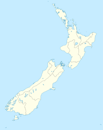
Ngatea

Ngatea
Ngatea
Ngatea (Neuseeland)
Ngatea
Koordinaten 37° 17′ S, 175° 30′ O-37.283333333333175.5Koordinaten: 37° 17′ S, 175° 30′ O
Einwohner 1.164 (2006)
Region Waikato
Distrikt Hauraki-Distrikt

Ngatea ist eine kleine Stadt auf den Hauraki Plains auf der Nordinsel Neuseelands. Sie liegt 18 km südwestlich von Thames und 70 km südöstlich von Auckland. Ngatea liegt am Piako River, 8 km südlich seiner Mündung in den Firth of Thames. Bei der Volkszählung 2006 hatte das statistische Gebiet „Ngatea“ 1164 Einwohner.

Ngatea ist das wirtschaftliche Zentrum der landwirtschaftlich, insbesondere für die Milchviehhaltung, genutzten Hauraki Plains. Die Stadt wurde nach 1900 gegründet, nachdem die Trockenlegung der Ebene eine landwirtschaftliche Nutzung ermöglicht hatte, zuvor war das Gebiet Sumpfland.

Die Stadt lebt auch von den Reisenden, die sie auf dem Weg von Auckland auf die Coromandel-Halbinsel und die Bay of Plenty über den State Highway 2 passieren.

Touristische Ziele in und um Ngatea sind die Wassergärten von Ngatea, der Kopuatai Peat Dome und eine Edelsteinfabrik.


Wikimedia Foundation.

Игры ⚽ Нужно решить контрольную?

Schlagen Sie auch in anderen Wörterbüchern nach:

  • Ngatea — …   Wikipedia

  • Ngatea — Original name in latin Ngatea Name in other language State code NZ Continent/City Pacific/Auckland longitude 37.28333 latitude 175.5 altitude 5 Population 1151 Date 2011 08 01 …   Cities with a population over 1000 database

  • Hauraki Plains — The Hauraki Plains are an area located in the northern North Island of New Zealand. They are located 75 kilometres southeast of Auckland, at the foot of the Coromandel Peninsula and occupy the southern portion of a rift valley bounded on the east …   Wikipedia

  • Hauraki Plains — Echtfarbenaufnahme des Satelliten Terra, 23. Oktober 2002. Die Hauraki plains liegen an der Basis der großen Bucht, des Firth of Thames, rechts unterhalb der Bildmitte …   Deutsch Wikipedia

  • List of schools in the Waikato Region — The Waikato Region of the North Island of New Zealand contains numerous small rural primary schools, some small town primary and secondary schools, and city schools in Hamilton. The rolls given here are those provided by the Ministry of Education …   Wikipedia

  • Piako River — The Piako River is located to the south of the Hauraki Gulf in the North Island of New Zealand. It is, with the Waihou River, one of the two main rivers which form the Hauraki Plains, at the southern end of the Firth of Thames.The Piako River… …   Wikipedia

  • Piako River — Der Piako River ist ein südlich des Hauraki Gulf auf der Nordinsel Neuseelands gelegener Fluss. Er ist zusammen mit dem Waihou River einer der wichtigsten Flüsse, die das Schwemmland der Hauraki Plains am Südende des Firth of Thames ablagerten.… …   Deutsch Wikipedia

  • Hauraki District — The Hauraki District Council is a municipality in the North Island of New Zealand. The seat of the council is at Paeroa.The area covered by the district extends from the southwest corner of the Firth of Thames southeast towards Te Aroha, although …   Wikipedia

  • Coromandel FM — is a regional radio station that broadcasts across the Coromandel Peninsula in New Zealand. The station broadcasts a Hot AC music format along with local and national news and talk programmes. The station was launched as a summer only station in… …   Wikipedia

  • Thames Valley Rugby Football Union — Rugby team teamname = Thames Valley Rugby Football Union nickname = Swamp Foxes | founded = 1921 ground = Te Aroha Domain and Paeroa Domain capacity = coach = flagicon|NZL Noel Pickrang league = Heartland Championship season = 2006 position =… …   Wikipedia

Share the article and excerpts

Direct link
Do a right-click on the link above
and select “Copy Link”