Orsasjön

Orsasjön
Orsasjön
Orsasjön norrifrån.JPG
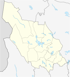
Geographische Lage Dalarna, Schweden
Zuflüsse Oreälven, Våmån
Abfluss Orsälven
Städte am Ufer Orsa
Daten
Koordinaten 61° 5′ 17″ N, 14° 32′ 49″ O61.08805555555614.546944444444161.7Koordinaten: 61° 5′ 17″ N, 14° 32′ 49″ O
Orsasjön (Dalarna)
Orsasjön
Höhe über Meeresspiegel 161,7 m ö.h.
Fläche 52,32 km²[1]
Volumen 0,890 km³dep1[2]
Maximale Tiefe 90 m[2]
Mittlere Tiefe 17,3 m[2]
Einzugsgebiet 3.310 km²[3]

Der Orsasjön ist ein See in der schwedischen Provinz Dalarnas län und der historischen Provinz Dalarna. Der See hat eine Fläche von 52,32 km² und eine größte Tiefe von 90 Metern. Er ist durch eine schmale Wasserstraße mit dem See Siljan verbunden. Der See wird vom Fluss Oreälven gespeist.

Am Ufer liegt die Gemeinde Orsa mit der gleichnamigen Stadt Orsa.

Einzelnachweise

  1. Sjöareal och sjöhöjd (3,32 MB; PDF), Svenskt vattenarkiv (SVAR), Sveriges meteorologiska och hydrologiska institut (schwedisch)
  2. a b c Sjödjup och sjövolym (712,6 kB; PDF), Svenskt vattenarkiv (SVAR), Sveriges meteorologiska och hydrologiska institut (schwedisch)
  3. VattenWeb, Sveriges meteorologiska och hydrologiska institut (schwedisch)

Wikimedia Foundation.

Игры ⚽ Поможем решить контрольную работу

Schlagen Sie auch in anderen Wörterbüchern nach:

  • Orsasjön — Sp Òšašionas Ap Orsasjön L ež. C Švedijoje …   Pasaulio vietovardžiai. Internetinė duomenų bazė

  • Orsasjön — Lago Orsa Países  Suecia Provincia Dalarna Superficie 53 km² Profundidad 94 m El la …   Wikipedia Español

  • Orsasee — Orsasjön Geographische Lage: Dalarna, Schweden Zuflüsse …   Deutsch Wikipedia

  • Orsa Municipality — Orsa kommun   Municipality   Country Sweden …   Wikipedia

  • Siljan (lake) — Siljan Landsat 7 satellite image Coordinates …   Wikipedia

  • Oreälven — Wasserfall des Oreälven unterhalb der E 45 44 km Luftlinie nördlich von OrsaVorlage:Infobox Fluss/KARTE fehlt …   Deutsch Wikipedia

  • Orsa (Gemeinde) — Gemeinde Orsa …   Deutsch Wikipedia

  • Mälaren — at dusk Location Sweden Coordinates …   Wikipedia

  • Mora, Sweden — Infobox Settlement official name = Mora image caption = Zorn Museum in Mora image shield = pushpin settlement type = Town subdivision type = Country subdivision name = Sweden subdivision type1 = Municipality subdivision name1 = Mora Municipality… …   Wikipedia

  • Oreälven — Coordinates: 61°07′40″N 14°35′00″E / 61.12778°N 14.5833333°E / 61.12778; 14.5833333 …   Wikipedia

Share the article and excerpts

Direct link
Do a right-click on the link above
and select “Copy Link”