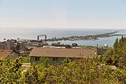
Park Point — Point Park may refer to:* Park Point (Minnesota), a neighborhood and sandbar in Duluth, Minnesota, USA * Park Point at RIT, a commercial enterprise on Rochester Institute of Technology s campus in Rochester, New York, USA * Point Park University … Wikipedia
Park Point (Minnesota) — Park Point is a neighborhood and sandbar in Duluth, Minnesota.Lake Avenue / Minnesota Avenue serves as a main arterial route in the community.Adjacent Neighborhoods (Directions following those of Duluth s general street grid system, not actual… … Wikipedia
Park Point at RIT — infobox shopping mall image width = 250px caption = shopping mall name = Park Point at RIT location = Henrietta, New York coordinates = coord|43.091519| 77.658319|display=inline opening date = September 27, 2008 developer = manager = Wilmorite… … Wikipedia
Point Douglas to Superior Military Road — Point Douglas to Superior Military Road, also known as Point Douglas to St. Louis River Military Road and as Douglas Highway, was a road the ran between Point Douglas, located at the outlet of the Lower St. Croix Lake near Hastings, Minnesota,… … Wikipedia
Point Monroe, Bainbridge Island, Washington — Point Monroe is a unique neighborhood on Bainbridge Island, Washington. Located on the northeastern end of the island, just north of Fay Bainbridge State Park, Point Monroe, also known as the Sandspit, is a thin strip of land that wraps around a… … Wikipedia
Point Lobos Ranch — is an area in the State of California, USA, owned by the California State Park System which is being held for possible use as a state park. Point Lobos Ranch is located south of Carmel by the Sea and east of Point Lobos State Reserve. The world s … Wikipedia
Point Reyes National Seashore — Infobox protected area | name = Point Reyes National Seashore iucn category = V caption = locator x = 3 locator y = 75 location = Marin County, California, USA nearest city = San Francisco, California lat degrees = 38 lat minutes = 03 lat seconds … Wikipedia
Point Cook, Victoria — Infobox Australian Place | type = suburb name = Point Cook city = Melbourne state = vic caption = A street of newly built houses in Point Cook in October 2006 lga = City of Wyndham postcode = 3030 pop = 14,162 (2006) [Census 2006 AUS | id =… … Wikipedia
Point Frederick, New South Wales — Infobox Australian Place name = Point Frederick city = Central Coast state = nsw caption = A view from President s Hill shows Point Frederick in the early days. lga = City of Gosford postcode = 2250 pop = 1,693 (2006 census) area = 0.6 est =… … Wikipedia
Point Lookout, New South Wales — Infobox Mountain Name = Point Lookout Photo = View from Point Lookout.jpg Photo size = 260 px Caption = The view from Point Lookout Elevation = 1564 m cite book |title=Discover Australia s National Parks |last=Hema Maps |first= |authorlink=… … Wikipedia

