Peloncillo Mountains

Peloncillo Mountains

p1f1

Peloncillo Mountains
Höchster Gipfel Gray Mountain (2.113 m)
Lage Arizona, New Mexico (USA)
Teil der Southeast Arizona Ranges
Peloncillo Mountains (Arizona)
Peloncillo Mountains
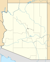
Koordinaten 31° 53′ N, 108° 55′ W31.875232-108.9225222113Koordinaten: 31° 53′ N, 108° 55′ W
Fläche 5.072 km²

Die Peloncillo Mountains sind ein bis zu 2113 m hohes Gebirge im Osten Arizonas (60 %) und im Westen New Mexicos (40 %). Das Gebirge gehört zu den Southeast Arizona Ranges und erstreckt sich über 174 Kilometer Nord-Süd und 76 Kilometer Ost-West. Die Fläche beträgt 5072 km². Höchste Erhebung ist der Gray Mountain in New Mexico mit einer Höhe von 2.113 m.

Berge

Name Bundesstaat Höhe
Gray Mountain New Mexico 2113 m
Guthrie Peak Arizona 2004 m
Peloncillo Mountains Arizona 1987 m
Whitlock Peak Arizona 1893 m
Whitlock Mountains High Point Arizona 1732 m

Weblinks


Wikimedia Foundation.

Игры ⚽ Нужна курсовая?

Schlagen Sie auch in anderen Wörterbüchern nach:

  • Peloncillo National Forest — was established as the Peloncillo Forest Reserve in Arizona and New Mexico on November 15, 1906 with 178,977 acres. It became a National Forest on March 4, 1907. On July 1, 1908 it was combined with Chiricahua National Forest and the name was… …   Wikipedia

  • Animas Mountains — Geobox | Range name=Animas Mountains image caption= country=United States state=New Mexico parent= geology=| border=Peloncillo Mountains| orogeny= length imperial=30| length orientation=N S width imperial=12 | width orientation= highest=Animas… …   Wikipedia

  • Chiricahua Mountains — Mountain Range Chiricahua Mountains northeast flank (at Portal, AZ) …   Wikipedia

  • List of Arizona Wilderness Areas — This is a List of Arizona Wilderness Areas. A second list contains the geographic landform that is most closely associated with it, or is in its proximity.Note: LCRV = Lower Colorado River Valley List of Arizona wilderness areas*Apache Creek… …   Wikipedia

  • List of mountain ranges of Arizona — There are 194 named mountain ranges in Arizona. The extra items listed may include::Mingus Mountain, the high, NW section of the Black Hills:Shiprock:Sierra Madre Occidental (of W continental Mexico) The list*Agua Caliente Mountains ndash;Yuma… …   Wikipedia

  • Coronado National Forest — IUCN Category VI (Managed Resource Protected Area) …   Wikipedia

  • Crotalus willardi — Kantenkopf Klapperschlange Kantenkopf Klapperschlange (Crotalus willardi) Systematik Ordnung: Schuppenkriechtiere (Squamata) …   Deutsch Wikipedia

  • Whitlock — Der Name Whitlock bezeichnet: folgende Personen: Albert Whitlock (1915–1999), britischer Künstler für Spezialeffekte in Spielfilmen (Matte Painting) Bob Whitlock (* 1931), US amerikanischer Jazz Bassist Bobby Whitlock (* 1948), US amerikanischer… …   Deutsch Wikipedia

  • Skeleton Canyon treasure — Skeleton Canyon is located in the Peloncillo Mountains, which straddles the modern Arizona and New Mexico state line border. This canyon connects the Animas Valley of New Mexico with the San Simon Valley of Arizona. Geromino s final surrendered… …   Wikipedia

  • National Landscape Conservation System — The National Landscape Conservation System (NLCS) is a 27 million acres (110,000 km2) collection of the lands considered to be the crown jewels of the American west. NLCS is also known as National Conservation Lands. These lands represent 10% of… …   Wikipedia

Share the article and excerpts

Direct link
Do a right-click on the link above
and select “Copy Link”