- Puerto Aroma
-
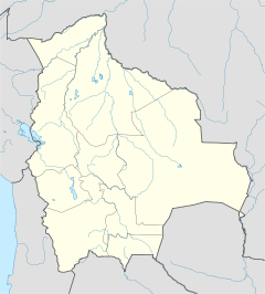
Puerto Aroma Basisdaten Einwohner (Stand) 205 Einw. (Volkszählung 2001) [1] Höhe 3.798 m Telefonvorwahl +591/ Koordinaten 17° 27′ S, 68° 8′ W-17.443611111111-68.1313888888893798Koordinaten: 17° 27′ S, 68° 8′ W Politik Departamento La Paz Provinz Gualberto Villarroel Klima Puerto Aroma ist eine Ortschaft im Departamento La Paz im südamerikanischen Anden-Staat Bolivien.
Inhaltsverzeichnis
Lage
Puerto Aroma liegt in der Provinz Gualberto Villarroel und ist die größte Ortschaft des Landkreises (Municipio) Chacarilla. Die Ortschaft liegt auf einer Höhe von 3.798 m am linken Ufer des Río Desaguadero, der den Titicaca-See mit dem Poopó-See verbindet.
Geographie
Puerto Aroma liegt auf dem bolivianischen Altiplano zwischen den Anden-Gebirgsketten der Cordillera Occidental im Westen und der Cordillera Central im Osten. Die mittlere Durchschnittstemperatur der Region liegt bei 9°C, der Jahresniederschlag beträgt etwa 450 mm[2]. Die Region weist ein ausgeprägtes Tageszeitenklima auf, die Monatsdurchschnittstemperaturen schwanken nur unwesentlich zwischen 7 °C im Juli und 11 °C im Dezember. die Monatsniederschläge liegen zwischen unter 10 mm in den Monaten Juni und Juli und nahe 100 mm von Dezember bis Februar.
Verkehrsnetz
Puerto Aroma liegt 145 km entfernt von La Paz, der Hauptstadt des gleichnamigen Departamentos. Von La Paz aus führt die asphaltierte Fernstraße Ruta 2 bis El Alto, von dort die Ruta 1 in südlicher Richtung als Asphaltstraße bis Patacamaya. Von dort aus führt die Ruta 4 über 17 km bis Cañaviri und weitere 8 km in südwestlicher Richtung bis zu einer ost-westlich verlaufenden Schichtstufe, die hier eine Höhe von 3950 m aufweist. Vom Rand dieser Schichtstufe aus führt eine unbefestigte Piste nach Süden bis Puerto Aroma.
Bevölkerung
Die Bevölkerungszahl der Ortschaft ist in dem Jahrzehnt von 1992 bis 2001 um etwa 60 Prozent angestiegen. Sie betrug 129 Einwohner bei der Volkszählung 1992[3] und dann 205 Einwohnern bei der Volkszählung 2001[4]. Neuere Daten liegen derzeit nicht vor.
Aufgrund der historisch gewachsenen Bevölkerungsverteilung weist die Region einen hohen Anteil an Aymara-Bevölkerung auf, im Municipio Chacarilla sprechen 97,0 % der Bevölkerung die Aymara-Sprache[5].Einzelnachweise
- ↑ Instituto Nacional de Estadística Bolivia (INE)
- ↑ Klimadiagramm Calacoto
- ↑ Instituto Nacional de Estadística Bolivia (INE) 1992
- ↑ Instituto Nacional de Estadística Bolivia (INE) 2001
- ↑ INE-Sozialdaten
Weblinks
- Municipio Chacarilla - Detailkarte und Bevölkerungsdaten (PDF; 354 kB) (spanisch)
- Departamento La Paz - Sozialdaten (spanisch) (PDF; 11,63 MB)
Kategorie:- Ort im Departamento La Paz
Wikimedia Foundation.

