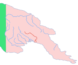
Purari River — River, eastern central New Guinea. Rising in the central highlands of Papua New Guinea, it flows about 290 mi (470 km) to the Gulf of Papua of the Coral Sea. Its lower course divides into five main channels that lace through a well settled swampy … Universalium
Purari River — Geobox River name = Purari map caption = Location of the Purari country = Papua New Guinea region = Gulf length = 470 length round = 0 length note = watershed = 33670 watershed round = 0 watershed note = discharge location = discharge average =… … Wikipedia
Purari language — Purari Spoken in Papua New Guinea Region Purari River, Gulf Province Native speakers 7,000 (1991) Language family Trans–New Guinea … Wikipedia
Purari — DatenVorlage:Infobox Fluss/GKZ fehlt Lage … Deutsch Wikipedia
Purari — may refer to: *Purari River *Purari language … Wikipedia
river — river1 riverless, adj. riverlike, adj. /riv euhr/, n. 1. a natural stream of water of fairly large size flowing in a definite course or channel or series of diverging and converging channels. 2. a similar stream of something other than water: a… … Universalium
Markham River — Coordinates: 6°44′20″S 146°58′5″E / 6.73889°S 146.96806°E / 6.73889; 146.96806 … Wikipedia
Gulf of Papua — The Gulf of Papua is a 400 kilometer wide region on the south shore of New Guinea. Some of New Guinea s largest rivers, such as the Fly River, Turama River, Kikori River and Purari River, flow into the gulf, making it a large delta. While the… … Wikipedia
Пурари (река) — Пурари Purari River Космический снимок реки Характеристика Длина 470 км … Википедия
Great Papuan Plateau — The Great Papuan Plateau is a karst [cite web|url=http://www.worldwildlife.org/expeditions/newguinea/read 1.cfm|author=Tanya Leary|title=Papua New Guinea A Mega diversity Hot Spot|work=World Wildlife Fund|access=2007 03 22] plateau in the… … Wikipedia