- Pylaia (Thessaloniki)
-
Gemeinde Pylea
Δήμος Πυλαίας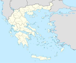

Basisdaten Staat: Griechenland Verwaltungsregion: Zentralmakedonien Präfektur: Thessaloniki Geographische Koordinaten: 40° 36′ N, 22° 59′ O40.60055555555622.9875Koordinaten: 40° 36′ N, 22° 59′ O Höhe ü. d. M.: 90 m
(Durchschnitt)Fläche: 24,634 km² Einwohner: 22.744 (2001[1]) Bevölkerungsdichte: 923,3 Ew./km² Gemeindelogo: 
Sitz: Pylea LAU-1-Code-Nr.: 543400 Gemeindegliederung: 1 Gemeindebezirk Website: www.pilea.gr Lage in der Präfektur Thessaloniki 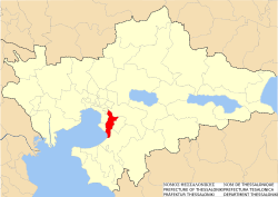
Pylea (griechisch Πυλαία (f. sg.), auch Pylaia) ist eine Gemeinde der Präfektur Thessaloniki innerhalb der Metropolregion Thessaloniki. Pylea hat eine Küstenlinie von 4,5 km an der Bucht von Thessaloniki bzw. am Thermaischen Golf) und erstreckt sich von Südwesten (Meer) nach Nordosten in Richtung des Berges Chortiatis.
Im Gebiet von Pylea wird in den Schriften des Thukydides die antike Siedlung Strepsa erwähnt (319 vor Christus). Unter osmanischer Besatzung trug die Siedlung den Namen Kapoutzida mit Bezug auf die türkische Bezeichnung für Wachmänner (die die Stadt Thessaloniki bewachten). 1927 wurde Kapoutzida in Pylea umbenannt, wobei das griechische Wort πύλη (píli), für „Tor“ (hier das östliche Tor nach Thessaloniki) Pate für den Namen stand.
Pylea soll der Betriebshof der U-Bahn von Thessaloniki werden (zur Zeit in Bau) und wäre damit zugleich auch vorläufiger südöstlicher Endpunkt der Hauptlinie.
Einzelnachweise

Gemeinden: Thessaloniki | Agios Pavlos | Ambelokipi | Eleftherio-Kordelio | Evosmos | Kalamaria | Menemeni | Neapoli | Polichni | Pylea | Stavroupoli | Sykies | Triandria
Vororte: Agios Athanasios | Axios | Vasilika | Epanomi | Efkarpia | Echedoros | Thermaikos | Thermi | Michaniona | Mikra | Panorama | Pefka | Chalastra | Chortiatis | Oreokastro
Gemeinden der Präfektur ThessalonikiAgios Athanasios | Agios Georgios | Agios Pavlos | Ambelokipi | Apollonia | Arethousa | Assiros | Axios | Chalastra | Chalkidona | Chortiatis | Echedoros | Efkarpia | Egnatia | Eleftherio-Kordelio | Epanomi | Evosmos | Kalamaria | Kallindia | Kallithea | Koronia | Koufalia | Lachanas | Langadas | Madytos | Menemeni | Michaniona | Mikra | Mygdonia | Neapoli | Oreokastro | Panorama | Pefka | Polichni | Pylea | Rendina | Sochos | Stavroupoli | Sykies | Thermaikos | Thermi | Thessaloniki | Triandria | Vasilika | Vertiskos


Wikimedia Foundation.