Russellville (Arkansas)

Russellville (Arkansas)
Icon tools.svg Dieser Artikel wurde aufgrund von inhaltlichen Mängeln auf der Qualitätssicherungsseite des Projektes USA eingetragen. Hilf mit, die Qualität dieses Artikels auf ein akzeptables Niveau zu bringen, und beteilige dich an der Diskussion!
US-GreatSeal-Obverse.svg
Russellville
Pope County Arkansas Incorporated and Unincorporated areas Russellville Highlighted.svg
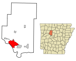
Lage im County und in Arkansas
Basisdaten
Staat: Vereinigte Staaten
Bundesstaat: Arkansas
County:

Pope County

Koordinaten: 35° 17′ N, 93° 8′ W35.278333333333-93.134166666667106Koordinaten: 35° 17′ N, 93° 8′ W
Zeitzone: Central Standard Time (UTC−6)
Einwohner: 23.682 (Stand: 2000)
Bevölkerungsdichte: 352,4 Einwohner je km²
Fläche: 67,3 km² (ca. 26 mi²)
davon 67,2 km² (ca. 26 mi²) Land
Höhe: 106 m
Vorwahl: +1 479
FIPS: 05-61670
GNIS-ID: 0079154

Russellville ist eine Stadt im Pope County im US-amerikanischen Bundesstaat Arkansas mit 24.800 Einwohnern (Stand: 2004) und ist Sitz der County-Verwaltung (County Seat). Das Stadtgebiet hat eine Größe von 67,2 km².

In Russelville befindet sich die Arkansas Tech University sowie das Kernkraftwerk Arkansas One.

Bevölkerungsentwicklung

Historische Einwohnerzahlen
Census Einwohner ± in %
1880 825
1890 1321 60 %
1900 1832 40 %
1910 2936 60 %
1920 4505 50 %
1930 5628 20 %
1940 5927 5 %
1950 8166 40 %
1960 8921 9 %
1970 11.750 30 %
1980 14.518 20 %
1990 21.260 50 %
2000 23.682 10 %
1880–2000[1]


Söhne und Töchter der Stadt

Einzelnachweise

  1. Auszug aus der Encyclopedia of Arkansas. Abgerufen am 13. Februar 2011

Wikimedia Foundation.

Игры ⚽ Нужно сделать НИР?

Schlagen Sie auch in anderen Wörterbüchern nach:

  • Russellville (Arkansas) — Saltar a navegación, búsqueda City of Russellville Localización en el Condado de Pope y en el estado de …   Wikipedia Español

  • Russellville, Arkansas — Infobox Settlement official name = Russellville, Arkansas settlement type = City imagesize = image caption = historic downtown Russellville image mapsize = 250px map caption = Location in Pope County and the state of Arkansas mapsize1 = map… …   Wikipedia

  • Russellville (Arkansas) — 35°16′42″N 93°8′13″O / 35.27833, 93.13694 …   Wikipédia en Français

  • Russellville — is the name of several communities in the United States: *Russellville, Alabama *Russellville, Arkansas *Russellville, Illinois *Russellville, Indiana *Russellville, Kentucky *Russellville, Missouri *Russellville, Ohio *Russellville, Tennessee… …   Wikipedia

  • Arkansas locations by per capita income — Arkansas is the forty eighth richest state in the United States of America, with a per capita income of $16,904 (2000). Arkansas Places Ranked by Per Capita Income # Morrison Bluff, Arkansas ndash; $56,436 # Prairie Creek, Arkansas ndash; $37,355 …   Wikipedia

  • Arkansas Army National Guard — Arkansas STARC Shoulder Sleeve insignia Active 1804–present Country United States …   Wikipedia

  • Arkansas Tech University — Infobox University name = Arkansas Tech University established = 1909 type = Public University president = Dr. Robert C. Brown enrollment = 7,480 city = Russellville state = Arkansas country = United States campus = Rural mascot = Wonder Boys… …   Wikipedia

  • Arkansas — This article is about the U.S. state of Arkansas. For the river, see Arkansas River. For other uses, see Arkansas (disambiguation). State of Arkansas …   Wikipedia

  • Arkansas State Highway 7 — Basisdaten Bundesstaat:  Arkansas Anfangspunkt:  Diamond City …   Deutsch Wikipedia

  • Arkansas Nuclear One — Infobox NPP Picture=Arkansas Nuclear One.jpeg Pic des=Arkansas Nuclear One Country=United States Status=O Utility=Entergy Location=Russellville, Arkansas Supplier=Unit 1: Babcock and Wilcox Unit 2: Combustion Engineering Type=Pressurized water… …   Wikipedia

Share the article and excerpts

Direct link
Do a right-click on the link above
and select “Copy Link”