Sabinio

Sabinio

f1

Sabinyo
Höhe 3.645 m
Lage Ruanda, Uganda, DR Kongo
Gebirge Virunga-Vulkane
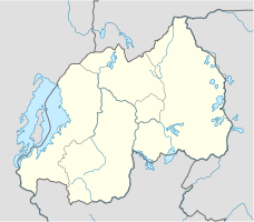
Geographische Lage 1° 24′ 0″ S, 29° 36′ 0″ O-1.429.63645Koordinaten: 1° 24′ 0″ S, 29° 36′ 0″ O
Sabinyo (Ruanda)
DEC
Sabinyo
Typ Schichtvulkan
Besonderheiten Heimat der Berggorillas in drei Nationalparks

Der Sabinyo (auch Sabyinyo, Sabinio) ist ein erloschener Vulkan am östlichen Ende der Virunga-Vulkankette. Der Berg liegt im Dreiländereck zwischen Ruanda, Uganda und der Demokratischen Republik Kongo. Auf der ruandischen Seite erstreckt sich der Vulkan-Nationalpark, auf der kongolesischen Seite der Virunga-Nationalpark und auf der ugandischen Seite der Mgahinga-Gorilla-Nationalpark. Die drei Nationalparks sind bekannt für die hier lebenden Berggorillas. An den Hängen des Sabyinyo lebt eine Gruppe von Gorillas, die an Touristen gewöhnt wurde und zu der regelmäßig kleine Besuchergruppen geführt werden. Die Gorillagruppe heißt nach ihrem Berg "Sabinyo" und wird von einem 30-jährigen und 2 m großen Silberrücken mit dem Namen Guhonda angeführt.

Weblinks


Wikimedia Foundation.

Игры ⚽ Поможем написать реферат

Schlagen Sie auch in anderen Wörterbüchern nach:

  • sabinio — m Unidad de absorciуn acъstica de una superficie, equivalente a 0,09 mІ (1 pulgadaІ) …   Diccionario de Construcción y Arquitectur

  • Sabinio — ▪ volcano, Africa also called  Volcan Sabinyo,  or  Volcan Sabyinyo,         extinct volcano (11,500 feet [3,505 m]) in the Virunga Mountains of east central Africa. It lies northeast of Lake Kivu and south southeast of Rutshuru, Congo (Kinshasa) …   Universalium

  • sabinio mйtrico — m Unidad de absorciуn del sonido que equivale a 1 mІ de una superficie perfectamente absorbente …   Diccionario de Construcción y Arquitectur

  • Sabyinyo — f1 Sabinyo Höhe 3.645 m Lage Ruanda, Uganda, DR Kongo Gebirge Virunga Vulkane …   Deutsch Wikipedia

  • Uganda — Ugandan, adj., n. /yooh gan deuh, ooh gahn /, n. an independent state in E Africa, between the NE Democratic Republic of the Congo and Kenya: member of the Commonwealth of Nations; formerly a British protectorate. 20,604,874; 91,065 sq. mi.… …   Universalium

  • Virunga Mountains — Volcanic range, east central Africa. Located north of Lake Kivu, it extends for about 50 mi (80 km) along the borders of Congo (Kinshasa), Rwanda, and Uganda. Of its eight major volcanic peaks, the highest is Karisimbi, while Nyiragongo is at the …   Universalium

  • Mount Sabyinyo — Sabyinyo from the south Elevation 3,645 m (11,959 ft) …   Wikipedia

  • Sabinyo — von der ruandesischen Südseite Höhe 3.645  …   Deutsch Wikipedia

  • Geographie de la Republique democratique du Congo — Géographie de la République démocratique du Congo Géographie de la République démocratique du Congo Continent Afrique Région Afrique centrale Coordonnées 0°00′N 25°00 …   Wikipédia en Français

  • Géographie De La République Démocratique Du Congo — Continent Afrique Région Afrique centrale Coordonnées 0°00′N 25°00 …   Wikipédia en Français

Share the article and excerpts

Direct link
Do a right-click on the link above
and select “Copy Link”