Sabyinyo

Sabyinyo

f1

Sabinyo
Höhe 3.645 m
Lage Ruanda, Uganda, DR Kongo
Gebirge Virunga-Vulkane
Geographische Lage 1° 24′ 0″ S, 29° 36′ 0″ O-1.429.63645Koordinaten: 1° 24′ 0″ S, 29° 36′ 0″ O
Sabinyo (Ruanda)
DEC
Sabinyo
Typ Schichtvulkan
Besonderheiten Heimat der Berggorillas in drei Nationalparks

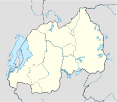
Der Sabinyo (auch Sabyinyo, Sabinio) ist ein erloschener Vulkan am östlichen Ende der Virunga-Vulkankette. Der Berg liegt im Dreiländereck zwischen Ruanda, Uganda und der Demokratischen Republik Kongo. Auf der ruandischen Seite erstreckt sich der Vulkan-Nationalpark, auf der kongolesischen Seite der Virunga-Nationalpark und auf der ugandischen Seite der Mgahinga-Gorilla-Nationalpark. Die drei Nationalparks sind bekannt für die hier lebenden Berggorillas. An den Hängen des Sabyinyo lebt eine Gruppe von Gorillas, die an Touristen gewöhnt wurde und zu der regelmäßig kleine Besuchergruppen geführt werden. Die Gorillagruppe heißt nach ihrem Berg "Sabinyo" und wird von einem 30-jährigen und 2 m großen Silberrücken mit dem Namen Guhonda angeführt.

Weblinks


Wikimedia Foundation.

Игры ⚽ Нужно сделать НИР?

Schlagen Sie auch in anderen Wörterbüchern nach:

  • Sabyinyo — Face sud du Sabyinyo Géographie Altitude 3 645 m Massif Montagnes des Virunga Coordonnées …   Wikipédia en Français

  • Mount Sabyinyo — Sabyinyo from the south Elevation 3,645 m (11,959 ft) …   Wikipedia

  • Liste von Vulkanen —  Karte mit allen Koordinaten: OSM, Google oder …   Deutsch Wikipedia

  • Virunga Mountains — Mount Nyiragongo Gahinga (left) and Muhabura (right) …   Wikipedia

  • Sabinio — f1 Sabinyo Höhe 3.645 m Lage Ruanda, Uganda, DR Kongo Gebirge Virunga Vulkane …   Deutsch Wikipedia

  • Dian Fossey — in November 1985; photograph by Yann Arthus Bertrand Born January …   Wikipedia

  • Volcanoes National Park — For the park in Hawaii, see Hawaii Volcanoes National Park. Volcanoes National Park ( fr. Parc National des Volcans) lies in northwestern Rwanda and borders Virunga National Park in the Democratic Republic of Congo and Mgahinga Gorilla National… …   Wikipedia

  • Mgahinga Gorilla National Park — IUCN Category II (National Park) …   Wikipedia

  • Mount Gahinga — Mts. Gahinga (left) and Muhabura (right) Elevation 3,474 m (11,398 ft) …   Wikipedia

  • List of Democratic Republic of the Congo-related articles — The Democratic Republic of the Congo ( fr. République démocratique du Congo), often referred to as DR Congo, DRC or RDC, and formerly known or referred to as Congo Free State, Belgian Congo, Congo Léopoldville, Congo Kinshasa, and Zaire (or Zaïre …   Wikipedia

Share the article and excerpts

Direct link
Do a right-click on the link above
and select “Copy Link”