- Sandoval County (New Mexico)
-
Verwaltung US-Bundesstaat: New Mexico Verwaltungssitz: Bernalillo Adresse des
Verwaltungssitzes:Gründung: Gebildet aus: Vorwahl: Demographie Einwohner: 89.908 (2000) Bevölkerungsdichte: 9,4 Einwohner/km² Geographie Fläche gesamt: 9.620 km² Wasserfläche: 13 km² Karte 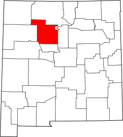
Website: www.sandovalcounty.com Sandoval County ist ein County im nördlichen Teil des US-Bundesstaates New Mexico. Es hat 89.908 Einwohner (Stand 2000). Der County Seat von Sandoval County ist in Bernalillo.
Am 20. Februar 2004 wurde Sandoval County das zweite US-amerikanische County nach San Francisco, in dem eine Heirat zwischen zwei Frauen gebilligt wurde.
Inhaltsverzeichnis
Geographie
Das County hat eine Fläche von 9.620 km², davon sind 9607 km² Land und 13 km² (0,13 %) Wasser. Sehenswürdigkeiten sind Bandelier National Monument, Kasha-Katuwe Tent Rocks National Monument, Coronado State Park und Fenton Lake State Park. In das County ragen Teile der Nationalforste Santa Fe National Forest und Cibola National Forest.
Nachbarcountys
- Rio Arriba County, Norden
- Los Alamos County, Nordosten
- Santa Fe County, Osten
- Bernalillo County, Süden
- Cibola County, Südwesten
- McKinley County, Westen
- San Juan County, Nordwesten
Städte und Dörfer
- Algodones
- Bernalillo
- Cochiti
- Cuba (New Mexico)
- Jemez Pueblo
- Jemez Springs
- La Jara
- Pena Blanca
- Placitas
- Ponderosa
- Pueblo of Sandia Village
- Regina (New Mexico)
- Rio Rancho
- San Felipe Pueblo
- San Ysidro
- Santa Ana Pueblo
- Santo Domingo Pueblo
- Torreon
- Zia Pueblo
Weblinks
- Sandoval County (englisch)

Bernalillo | Catron | Chaves | Cibola | Colfax | Curry | De Baca | Doña Ana | Eddy | Grant | Guadalupe | Harding | Hidalgo | Lea | Lincoln | Los Alamos | Luna | McKinley | Mora | Otero | Quay | Rio Arriba | Roosevelt | San Juan | San Miguel | Sandoval | Santa Fe | Sierra | Socorro | Taos | Torrance | Union | Valencia
35.69-106.85Koordinaten: 35° 41′ N, 106° 51′ W

Wikimedia Foundation.