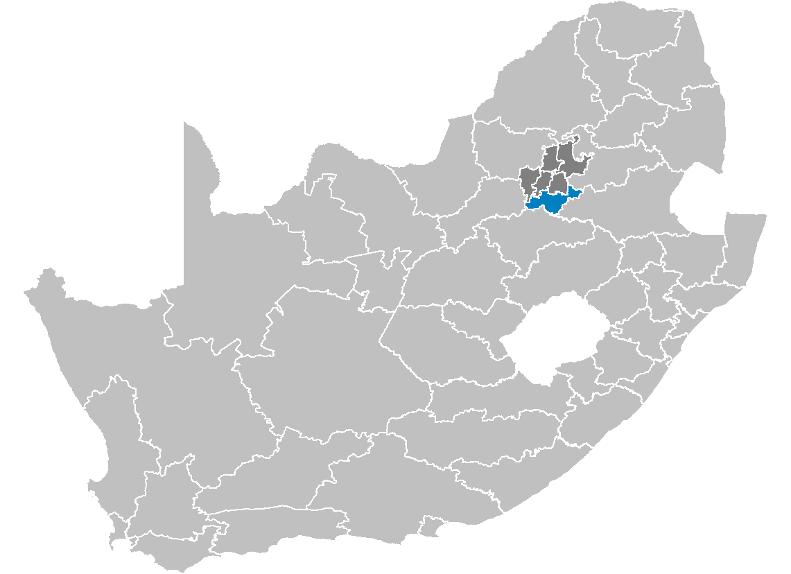
Sedibeng District

Sedibeng District
Sedibeng
Sedibeng District Municipality
Sedibeng in Gauteng
Sedibeng (blau) in Gauteng (dunkelgrau)
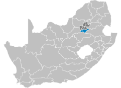
Staat: Südafrika
Provinz: Gauteng
Verwaltungssitz: Vereeniging
Einwohner: 798.280
(2001)
Fläche: 4.200 km²
Webpräsenz: www.sedibeng.gov.za
(englisch)

Sedibeng ist der südlichste Distrikt innerhalb der Provinz Gauteng in Südafrika. Im Jahr 2001 betrug die Bevölkerung 798.280 auf einer Gesamtfläche von 4.200 km². Sitz der Distriktverwaltung ist Vereeniging.

Der Distrikt ist ein Zentrum der Montanindustrie, vor allem der Eisenverhüttung und des Steinkohlebergbaus. Hier befindet sich einer der größten Staudämme Südafrikas, der Vaal-Stausee, der für die Energiegewinnung genutzt wird.

Sedibeng ist der Sesotho-Begriff für „am Brunnen“ oder „an der Quelle“. Der Distrikt liegt am Vaal, welcher hier die Grenze zwischen den Provinzen Gauteng und Freistaat bildet.[1]

Inhaltsverzeichnis

Gemeindestruktur

Als Beispiel für die Infrastruktur hier die Wasserversorgung der Haushalte (HWA = eigener Hauswasseranschluss; ÖWA = öffentlicher Wasseranschluss in der Nähe; KWA = kein Anschluss an ein Wasserleitungsnetz) [2]:

Gemeinde            Verwaltungssitz Fläche Einwohner    H W A Ö W A K W A
Emfuleni Vereeniging 966 km² 658.9281 25% 72% 3%
Lesedi Heidelberg (Gauteng) 1.786 km² 74.201 11% 77% 12%
Midvaal Meyerton 1.725 km² 65.151 20% 60% 19%

Sehenswürdigkeiten

Weblinks

Einzelnachweise

  1. Namensbedeutung Municipalities
  2. Gemeindestatistik Südafrika

-26.6527.9666666666677Koordinaten: 27° S, 28° O


Wikimedia Foundation.

Игры ⚽ Поможем написать реферат

Schlagen Sie auch in anderen Wörterbüchern nach:

  • Sedibeng District Municipality — Sedibeng is one of the districts of Gauteng province of South Africa. The seat of Sedibeng is Vereeniging. The largest mother tongue among the 794 605 people is Sotho (2001 Census). The district code is DC42.EtymologyThe name means The place of… …   Wikipedia

  • Sedibeng District Municipality — Admin ASC 2 Code Orig. name Sedibeng District Municipality Country and Admin Code ZA.06.DC42 ZA …   World countries Adminstrative division ASC I-II

  • Sedibeng — District Municipality Symbole …   Deutsch Wikipedia

  • South African municipal election, 2006, in Sedibeng District Municipality — The African National Congress won:* Emfuleni * LesediThe Democratic Alliance won:* Midvaal …   Wikipedia

  • Dr Kenneth Kaunda District Municipality — A map of the North West showing Dr Kenneth Kaunda Dr Kenneth Kaunda District Municipality (formerly Southern District Municipality[1]) is one of the 4 districts of North West province of South A …   Wikipedia

  • Fezile Dabi District Municipality — Fezile Dabi   District municipality   Location of Fezile Dabi District Municipality …   Wikipedia

  • Dr Kenneth Kaunda District Municipality — Dr Kenneth Kaunda Dr Kenneth Kaunda District Municipality Dr Kenneth Kaunda (blau) in Nordwest (dunkelgrau) Staat: Südafrika …   Deutsch Wikipedia

  • Metsweding District — Metsweding Metsweding District Municipality Metsweding (blau) in Gauteng (dunkelgrau) Staat: Südafrika …   Deutsch Wikipedia

  • Nkangala District Municipality — A map of Mpumalanga showing the Nkangala district Nkangala is one of the 3 districts of Mpumalanga province of South Africa. The seat of Nkangala is Middelburg. The Nkangala District Municipality consists of 160 towns and villages. The most… …   Wikipedia

  • Metsweding District Municipality —   District municipality   Location in …   Wikipedia

Share the article and excerpts

Direct link
Do a right-click on the link above
and select “Copy Link”