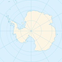
Shackleton Ice Shelf — (coord|66|00|S|100|00|E|type:glacier region:AQ|display=inline,title) is an extensive ice shelf fronting the coast of East Antarctica for about 384 km (95E to 105E), projecting seaward about 145 km in the western portion and 64 km in the east. The … Wikipedia
Shackleton Ice Shelf — ▪ Antarctica sheet of floating ice bordering Queen Mary Coast, Antarctica, on the Indian Ocean. It was discovered and named for Ernest Shackleton, the British explorer, by Douglas Mawson s (Mawson, Sir Douglas) expedition, 1911–14. It lies… … Universalium
Henderson Island (Shackleton Ice Shelf) — Henderson Island is an ice covered island 9 miles long and rising to 240 m, lying 9 miles southeast of Masson Island within the Shackleton Ice Shelf. Henderson Island is located at coord|66|22|S|97|10|E|. Henderson Island was discovered in August … Wikipedia
Ice shelf — An ice shelf is a thick, floating platform of ice that forms where a glacier or ice sheet flows down to a coastline and onto the ocean surface. Ice shelves are found in Antarctica, Greenland and Canada only. The boundary between the floating ice… … Wikipedia
Ice shelf — Barrière de glace Principales barrières de glace de l Antarctique Barrière de Ross (472 960 km²) … Wikipédia en Français
Wordie Ice Shelf — The Wordie Ice Shelf (coord|69|15|S|067|45|W|type:glacier region:AQ|display=inline,title) is a confluent glacier projecting as an ice shelf into the SE part of Marguerite Bay between Cape Berteaux and Mount Edgell, along the western coast of… … Wikipedia
Ross Ice Shelf — Barrière de Ross 81°30′S 175°00′W / 81.5, 175 … Wikipédia en Français
Shackleton — may refer to:* Ernest Shackleton (1874–1922), British Antarctic explorer * Derek Shackleton (1924–2007), British cricketer * Shackleton (surname), people with the surname Shackleton * Shackleton (crater), a crater at the south pole of the Moon *… … Wikipedia
Riiser-Larsen Ice Shelf — (coord|72|40|S|16|0|W|) is an ice shelf about 250 miles (400 km) long on the coast of Queen Maud Land, extending from Cape Norvegia in the north to Lyddan Island and Stancomb Wills Glacier in the south. Parts of the ice shelf were sighted by… … Wikipedia
Ice rise — An ice rise is a clearly defined elevation of the otherwise totally flat ice shelf, typically dome shaped and rising 100 to 200 meters above the surrounding ice shelf. An ice rise forms where the ice shelf touches the rocky seabed because of an… … Wikipedia

