Springfield (South Island)
- Springfield (South Island)
-
 |
In diesem Artikel oder Abschnitt fehlen wichtige Informationen.
Du kannst Wikipedia helfen, indem du sie recherchierst und einfügst.
|
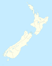
Springfield ist ein Dorf mit 219 Einwohnern (Stand: 2001) auf der Südinsel Neuseelands. Es befindet sich an der Bahnstrecke des TranzAlpine zwischen Christchurch und Greymouth in der Region Canterbury.
Wikimedia Foundation.
Schlagen Sie auch in anderen Wörterbüchern nach:
Springfield (Ortsname) — Springfield ist ein häufiger Ortsname in den USA, im Vereinigten Königreich und weiteren englischsprachigen Räumen. Inhaltsverzeichnis 1 Namenkunde und Verbreitung 2 Springfield in der Fiktion 3 Orte namens Springfield … Deutsch Wikipedia
Cities and towns in the South Island — This is a list of Cities and towns in the South Island of New Zealand: Contents: Top · 0–9 A B C D E F G H I J K L M N O P Q R S T U V W X Y Z A … Wikipedia
Liste der Orte namens Springfield — Springfield ist ein häufiger Ortsname in den USA, im Vereinigten Königreich und weiteren englischsprachigen Räumen. Inhaltsverzeichnis 1 Namenkunde und Verbreitung 2 Springfield in der Fiktion 3 Orte namens Springfield 3.1 USA … Deutsch Wikipedia
Springfield — fixhtml|begSpringfield may refer to:*Springfield (toponym), the place name in general *Springfield (The Simpsons), the fictional hometown of the Simpson family in The Simpsons * $pringfield (Or, How I Learned to Stop Worrying and Love Legalized… … Wikipedia
Springfield Indians — Gründung 1926 Auflösung 1994 Geschichte Springfield Indians 1926 – 1951 … Deutsch Wikipedia
Springfield Junction (Long Island Rail Road) — Springfield Junction was a junction between the Long Island Rail Road s Montauk Branch and Atlantic Branch in Laurelton, Queens, New York City, United States. It was located at the place where those two branches now begin to parallel, just east… … Wikipedia
South Ozone Park, Queens — South Ozone Park Neighborhoods of New York City Rockaway Boulevard Country … Wikipedia
Springfield Gardens, Queens — Springfield Gardens is a neighborhood in the southeastern area of the New York City borough of Queens, bounded to the north by St. Albans, to the east by Laurelton Rosedale, to the south by John F. Kennedy International Airport, and to the west… … Wikipedia
South Dakota — • The thirty ninth state, admitted to the Union on 2 November, 1889 Catholic Encyclopedia. Kevin Knight. 2006. South Dakota South Dakota … Catholic encyclopedia
Springfield (Illinois) — Pour les articles homonymes, voir Springfield. 39° 47′ 00″ N 89° 39′ 01″ W … Wikipédia en Français