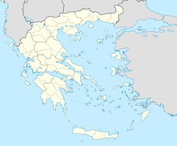
Stavrodromi — For the village in the Pella Prefecture, see Stavrodromi, Pella Stavrodromi (Greek, Modern: Σταυροδρόμι, Anciet/Katharevousa: ον on meaning the crossroads), older forms: o and on is a Greek village located south of Patras, west of Kalavryta, west … Wikipedia
Stavrodromi Hotel — (Игуменица,Греция) Категория отеля: 1 звездочный отель Адрес: Souliou 16, Игуменица, 46100 … Каталог отелей
Tritaia — Gemeinde Tritea Δήμος Τριταίας (Τριταία) DEC … Deutsch Wikipedia
Tritaia — may also refer to an ancient city in the prefecture of Phocis, see Tritaia, Phocis Tritaia or Tritea (Greek: Τριταία) is a municipality in Achaea, Greece. Population 5,462 (2001). The seat of the municipality is in Stavrodromi. The municipality… … Wikipedia
Tritea — Stadtgemeinde Tritea (1997–2010) Δήμος Τριταίας (Τριταία) … Deutsch Wikipedia
Achaea — Infobox Pref GR name = Achaea name local = Νομός Αχαΐας periph = West Greece capital = Patras population = 331,316 population as of = 2005 pop rank = 5th pop dens = 101.3 popdens rank = 9th area = 3,271.507 area rank = 14th postal code = 25x xx… … Wikipedia
Patras Province — Patras is a province and a region covering the western part of the Achaea prefecture. Several parts do not recognize it as a province and are not used in addresses but as a region. The main places includes Patras, Kato Achaia, Ovrya, Rio and… … Wikipedia
GR-EO20 — Datei:Flag of Greece.svg Nationalstraße 20 (Ethiniki Odos 20) Länge: ca. 150 km … Deutsch Wikipedia
Liste bulgarischer Bezeichnungen griechischer Orte — Dieser Artikel oder Abschnitt bedarf einer Überarbeitung. Näheres ist auf der Diskussionsseite angegeben. Hilf mit, ihn zu verbessern, und entferne anschließend diese Markierung. In dieser Liste werden die südslawischen den griechischen… … Deutsch Wikipedia
Liste mazedonischer Bezeichnungen griechischer Orte — Dieser Artikel oder Abschnitt bedarf einer Überarbeitung. Näheres ist auf der Diskussionsseite angegeben. Hilf mit, ihn zu verbessern, und entferne anschließend diese Markierung. In dieser Liste werden die südslawischen den griechischen… … Deutsch Wikipedia

