Sylvania Mountains

Sylvania Mountains

p1f1p3p5

Sylvania Mountains
Lage Kalifornien, Nevada (USA)
Sylvania Mountains (Kalifornien)
Sylvania Mountains
Koordinaten 37° 23′ N, 117° 44′ W37.385486111111-117.731477777782416Koordinaten: 37° 23′ N, 117° 44′ W
Geländeprofil der Region zwischen Kalifornien und Nevada rund um das Death Valley

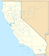
Die Sylvania Mountains sind eine Bergkette am östlichen Rand von Kalifornien und in Nevada in den USA. Die Sylvania Mountains ziehen sich in einer ost-westlichen Richtung nördlich der Last Chance Range am nördlichen Rand des Death Valley National Park entlang. Am östlichen Rand des Geländes erreichen die Berge eine Höhe von ca. 2.400 Metern. Das Gebiet ist zum größten Teil öffentlicher Grund und Boden und wird als Sylvania Mountains Wilderness vom Bureau of Land Management, einer Behörde des US-Innenministeriums verwaltet. Die nächstgelegene Stadt ist das ungefähr 50 Kilometer entfernte Bishop.

Weblink

Genaue Beschreibung beim Bureau of Land Management (engl.)


Wikimedia Foundation.

Игры ⚽ Поможем написать курсовую

Schlagen Sie auch in anderen Wörterbüchern nach:

  • Sylvania Mountains — The Sylvania Mountains are located in California and Nevada in the United States. The range trends in an east west direction north of the Last Chance Range at the northern end of Death Valley National Park.The Sylvania Mountains Wilderness… …   Wikipedia

  • Sylvania Mountains Wilderness — Infobox protected area | name = Sylvania Mountains Wilderness iucn category = Ib caption = Map of the United States locator x = 30 locator y = 88 location = nearest city = Bishop, California lat degrees = 32 lat minutes = 22 lat seconds = 41 lat… …   Wikipedia

  • Chuckwalla Mountains — Coordinates: 33°35′30.084″N 115°22′32.937″W / 33.59169°N 115.37581583°W / 33.59169; 115.37581583 …   Wikipedia

  • Coxcomb Mountains — Coordinates: 33°56′12.047″N 115°20′30.936″W / 33.93667972°N 115.34192667°W / 33.93667972; 115.34192667 …   Wikipedia

  • Chemehuevi Mountains — Coordinates: 34°37′30.031″N 114°31′32.863″W / 34.62500861°N 114.52579528°W / 34.62500861; 114.52579528 …   Wikipedia

  • Orocopia Mountains — Coordinates: 33°34′0.086″N 115°46′32.974″W / 33.56669056°N 115.77582611°W / 33.56669056; 115.77582611 …   Wikipedia

  • Newberry Mountains (California) — For the mountains with the same name in Nevada see Newberry Mountains (Nevada). Coordinates: 34°46′29.963″N 116°43′33.114″W /  …   Wikipedia

  • Old Woman Mountains Wilderness — IUCN Category Ib (Wilderness Area) …   Wikipedia

  • List of mountains of Oregon — Mountains of Oregon above 7,000 feet (2,134 m) in elevation The mountains in the U.S. state of Oregon include: Mount Ashland Aspen Butte Mount Bachelor Mount Bailey (Oregon) Bald Peak Mount Baldy (Polk County, Oregon …   Wikipedia

  • Mount Sylvania — Top as seen from Tualatin Elevation 978 ft (298 m)  …   Wikipedia

Share the article and excerpts

Direct link
Do a right-click on the link above
and select “Copy Link”