- Sátão
-
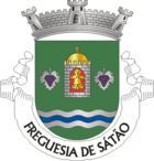
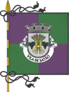
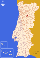
Sátão Wappen Karte 
Basisdaten Region: Centro Unterregion: Dão-Lafões Distrikt: Viseu Concelho: Sátão Koordinaten: 40° 45′ N, 7° 44′ W40.743055555556-7.7330555555556Koordinaten: 40° 45′ N, 7° 44′ W Einwohner: 4.210 (Stand: 2006) Kreis Sátão Flagge Karte 

Einwohner: 14968 (Stand: 2001) Fläche: 198,4 km² Bevölkerungsdichte: 75,44 Einwohner pro km² Anzahl der Gemeinden: 12 Verwaltung Adresse der Verwaltung: Câmara Municipal de Sátão
Praça Paulo VI
3560 SátãoWebpräsenz: www.cm-satao.pt Sátão ist eine Kleinstadt (Vila) in Portugal.
Geschichte
Sátão bekam 1951 das Stadtrecht.
Verwaltung
 Sátão ist Verwaltungssitz eines gleichnamigen Kreises. Die Nachbarkreise sind (im Uhrzeigersinn im Norden beginnend): Moimenta da Beira, Sernancelhe, Aguiar da Beira, Penalva do Castelo, Viseu sowie Vila Nova de Paiva.
Die folgenden Gemeinden (freguesias) liegen im Kreis Sátão:
- Águas Boas
- Avelal
- Decermilo
- Ferreira de Aves
- Forles
- Mioma
- Rio de Moinhos
- Romãs
- São Miguel de Vila Boa
- Sátão
- Silvã de Cima
- Vila Longa
- Lajes
Weblinks
-
 Commons: Sátão – Sammlung von Bildern, Videos und Audiodateien
 - Karte der Freguesia Sátão beim Instituto Geográfico do Exército
Armamar | Carregal do Sal | Castro Daire | Cinfães | Lamego | Mangualde | Moimenta da Beira | Mortágua | Nelas | Oliveira de Frades | Penalva do Castelo | Penedono | Resende | Santa Comba Dão | São João da Pesqueira | São Pedro do Sul | Sátão | Sernancelhe | Tabuaço | Tarouca | Tondela | Vila Nova de Paiva | Viseu | Vouzela
Wikimedia Foundation.
Schlagen Sie auch in anderen Wörterbüchern nach:
Sátão — Bandera … Wikipedia Español
Sátão — Géolocalisation sur la carte : Portugal … Wikipédia en Français
Satao — Sátão Sátão Administration Pays Portugal Région Centre Sous région Dão Lafões Ancienne province Beira Alt … Wikipédia en Français
Sátão — Infobox Municipality pt official name = Sátão image coat of arms = SAT.png Region = Centro Subregion = Dão Lafões District = Viseu Mayor name = Alexandre Vaz Mayor party = PSD area total = 201.9 population total = 13,419 population density = 66… … Wikipedia
Satao — Original name in latin Sto Name in other language Satam, Satao, Sto, Vila da Igreja, Vila de Igreja State code PT Continent/City Europe/Lisbon longitude 40.74178 latitude 7.73286 altitude 606 Population 4034 Date 2012 01 17 … Cities with a population over 1000 database
Satão — Sp Satáunas Ap Satão L Portugalija … Pasaulio vietovardžiai. Internetinė duomenų bazė
Satao — Admin ASC 2 Code Orig. name Sátão Country and Admin Code PT.22.1817 PT … World countries Adminstrative division ASC I-II
Sátão (freguesia) — Sátão Freguesia de Portugal … Wikipedia Español
Rio de Moinhos (Sátão) — Saltar a navegación, búsqueda Rio de Moinhos Freguesia de Portugal … Wikipedia Español
Mioma (Sátão) — Para el tipo de tumor, véase mioma. Mioma Freguesia de Portugal … Wikipedia Español


