Tablelands Regional Council
- Tablelands Regional Council
-
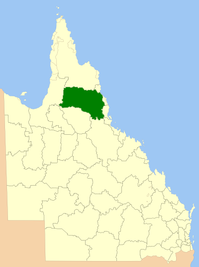
Tablelands Regional Council ist ein lokaler Regierungsbezirk in den Atherton Tablelands in Nord-Queensland, Australien. Er wurde im März 2008 gegründet und umfasst die folgenden ehemaligen Kreise/Bezirke mit den dazugehörigen Städten:
- Shire of Atherton (Kairi, Tinaroo, Tolga, Atherton)
- Shire of Eacham (Butchers Creek, Jaggan, Millaa Millaa, Peeramon, Tarzali, Yungaburra, Malanda)
- Shire of Herberton (Mount Garnet, Ravenshoe, Herberton)
- Shire of Mareeba (Chillagoe, Dimbulah, Kuranda, Mareeba, Mount Molloy)
Der Tablelands Regional Council hat eine Fläche von 64.999 km², mit etwa 42.165 Einwohnern.
Kategorie: - Local Government Area in Queensland
Wikimedia Foundation.
Schlagen Sie auch in anderen Wörterbüchern nach:
Tablelands Regional Council — is a Local Government Area in Queensland, Australia. The Local Government Area was created in March 2008 as a result of the report of the Local Government Reform Commission released in July 2007. The new Council, located in Far North Queensland,… … Wikipedia
Cairns Regional Council — Infobox Australian Place | type = lga name = Cairns Regional Council state = qld imagesize= 180 caption = Location within Queensland pop = 152,000 (2008) area = 152103 area footnotes = ( After 2008 Amalgamations with Douglass Shire Council ) est … Wikipedia
Northern Tablelands — Livestock grazing country, Irish Town, Walcha Dangars La … Wikipedia
Liverpool Plains Shire Council — Infobox Australian Place | type = lga name = Liverpool Plains Shire state = nsw caption = Location in New South Wales pop = 7,910 density = 1.55 area = 5086 est = seat = Quirindi (60 Station Street mayor = Ian Lobsey region = North West Slopes… … Wikipedia
Palerang Council — Infobox Australian Place | type = lga name = Palerang state = nsw caption = Location in NSW pop = 11,470 cite web publisher = Australian Bureau of Statistics title=Regional Population Growth, Australia, 2004 05 url =… … Wikipedia
Yass Valley Council — Infobox Australian Place | type = lga name = Yass Valley state = nsw caption = Location in NSW pop = 9,675 [ cite web publisher = Australian Bureau of Statistics title=Regional Population Growth, Australia, 2004 05 url =… … Wikipedia
Goulburn Mulwaree Council — Infobox Australian Place | type = lga name = Goulburn Mulwaree state = nsw caption = Location in NSW pop = 27,112 cite web publisher = Australian Bureau of Statistics title=Regional Population Growth, Australia, 2004 05 url =… … Wikipedia
Armidale Dumaresq Council — Infobox Australian Place | type = lga name = Armidale Dumaresq state = nsw caption = Location in NSW pop = 24,749cite web publisher = Australian Bureau of Statistics title= Armidale Dumaresq (A) (Local Government Area) work=2001 Census QuickStats … Wikipedia
Tenterfield Shire Council — Infobox Australian Place | type = lga name = Tenterfield Shire caption = Location in NSW state=New South Wales region=New England area=7332 seat=Tenterfield (247 Rouse Street)cite web title=Tenterfield Shire Council publisher = Department of… … Wikipedia
Glen Innes Severn Council — Infobox Australian Place | type = lga name = Glen Innes Severn caption = Location in New South Wales state=New South Wales region=New England area=5487 seat=Glen Innes (265 Grey Street)cite web title=Glen Innes Severn Council publisher =… … Wikipedia