Tabula Rogeriana

Tabula Rogeriana
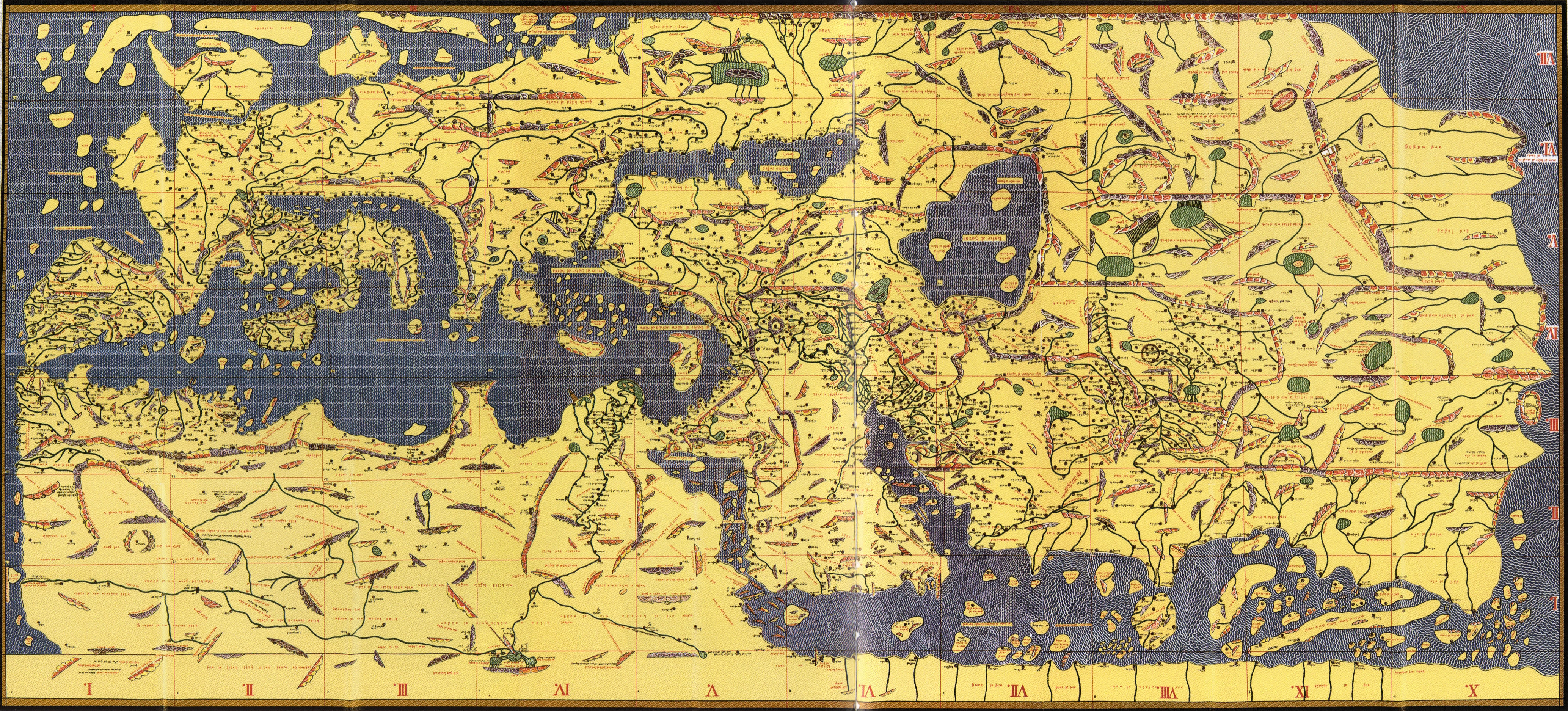
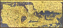
Die Tabula Rogeriana, von Al-Idrisi für Roger II. von Sizilien, 1154.

Die Tabula Rogeriana (dt. "Die Karte von Roger") ist eine 1154 angefertigte Weltkarte des arabischen Geographen Al-Idrisi. Al-Idrisi arbeitete 18 Jahre lang am Hofe des normannischen Königs Roger II. von Sizilien an den Illustrationen und Kommentaren der Karte. Sie zeigt den gesamten eurasischen Kontinent und den Norden Afrikas. Sie ist arabisch beschrieben und, entgegen heutig gebräuchlicher Karten, in Süd-Nord-Richtung ausgerichtet.


Wikimedia Foundation.

Игры ⚽ Поможем решить контрольную работу

Schlagen Sie auch in anderen Wörterbüchern nach:

  • Tabula Rogeriana — The Tabula Rogeriana (Lit. The map of Roger ) was a world map drawn by the Arab geographer, Muhammad al Idrisi, in 1154. Al Idrisi worked on the accompanying commentaries and illustrations of the map ( the Book of Roger ) for eighteen years at… …   Wikipedia

  • Muhammad al-Idrisi — The Tabula Rogeriana, drawn by al Idrisi for Roger II of Sicily in 1154, one of the most advanced ancient world maps. Modern consolidation, created from the 70 double page spreads of the original atlas …   Wikipedia

  • Early world maps — Ptolemy s world map (2nd century) in a 15th century reconstruction Early world maps cover depictions of the world from the Iron Age to the Age of Discovery and the emergence of modern geography during the early modern period …   Wikipedia

  • History of cartography — The Fra Mauro map, one of the greatest memorial of medieval cartography, was made around 1450 by the Venetian monk Fra Mauro. It is a circular world map drawn on parchment and set in a wooden frame, about two meters in diameter Cartography (from… …   Wikipedia

  • Histoire Cartographique De L'Arménie — Histoire de l Arménie Origines Hayasa Azzi • Nairi Urartu …   Wikipédia en Français

  • Histoire cartographique de l'Armenie — Histoire cartographique de l Arménie Histoire de l Arménie Origines Hayasa Azzi • Nairi Urartu …   Wikipédia en Français

  • Histoire cartographique de l'Arménie — Histoire de l Arménie Origines Hayasa Azzi • Nairi Urartu Armens …   Wikipédia en Français

  • Histoire cartographique de l'arménie — Histoire de l Arménie Origines Hayasa Azzi • Nairi Urartu …   Wikipédia en Français

  • Histoire des cartes de l'Arménie — Histoire cartographique de l Arménie Histoire de l Arménie Origines Hayasa Azzi • Nairi Urartu …   Wikipédia en Français

  • История картографии — Картография (от др. греч. χάρτης  «хартия, лист папируса» и γράφω  «пишу»), или наука об исследовании, моделировании и отображении пространственного расположения, сочетания и взаимосвязи объектов и явлений природы и общества, является… …   Википедия

Share the article and excerpts

Direct link
Do a right-click on the link above
and select “Copy Link”