Tangalan — 11° 46′ 34″ N 122° 15′ 36″ E / 11.776, 122.26 … Wikipédia en Français
Tangalan — Original name in latin Tangalan Name in other language Dapdap Tangalan, Tangalan State code PH Continent/City Asia/Manila longitude 11.7789 latitude 122.2634 altitude 0 Population 0 Date 2011 07 31 … Cities with a population over 1000 database
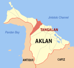
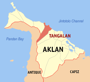
Tangalan, Aklan — Tangalan is a 5th class municipality in the province of Aklan, Philippines. According to the 2000 census, it has a population of 17,606 people in 3,317 households.Tourist spots with government support under Project Bugna include Jawili Falls,… … Wikipedia
Tangalan (Aklan) — Tangalan Carte de la province d Aklan avec localisation de Tangalan Tangalan est une municipalité de la province d Aklan, aux Philippines. Municipalités d Aklan … Wikipédia en Français
Makato, Aklan — Map of Aklan showing the location of Makato Makato is a 4th class municipality in the province of Aklan, Philippines. According to the 2000 census, it has a population of 22,777 people in 4,342 households. In 1948, the arrabal of Tangalan,… … Wikipedia
Nissan Island — [1] Green Islands seen from space. Oval shaped Nissan Island is clearly visible in the center. Nissan Island (also Green Island) is the largest of the Green Islands of Papua New Guinea. It is located at … Wikipedia
Ibajay — Municipality of Ibajay Lage von Ibajay in der Provinz Aklan Basisdaten Bezirk: Western Vis … Deutsch Wikipedia
PH-AKL — Lage von Aklan auf der Insel Panay Aklan ist die kleinste Provinz auf der Insel Panay, die zu dem Inselstaat der Philippinen gehört. Aklan hat eine Fläche von 1.817,90 Km² und 451.314 Einwohner. Die Hauptstadt der Provinz ist Kalibo.… … Deutsch Wikipedia
Malinao, Aklan — Map of Aklan showing the location of Malinao Malinao is a 4th class municipality in the province of Aklan, Philippines. It is located on Panay Island, geographical location 122° 10 to 122° 19 East, 11° 40 to 10° 35 North. It has an area of… … Wikipedia
Ibajay, Aklan — Ibajay is a 4th class municipality in the province of Aklan, Philippines. According to the 2000 census, it has a population of 39,643 people in 7,918 households.HistoryEarly historyThe organized human occupation of Ibajay can be traced back at… … Wikipedia