Timfristos

Timfristos
Tymfristos
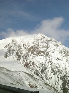
Tymfristos im Winter

Tymfristos im Winter

Höhe 2.315 m
Lage Präfektur Evrytania, Griechenland
Gebirge Pindos-Gebirge
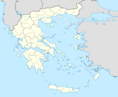
Geographische Lage 38° 57′ 0″ N, 21° 49′ 0″ O38.9521.8166666666672315Koordinaten: 38° 57′ 0″ N, 21° 49′ 0″ O
Tymfristos (Griechenland)
DEC
Tymfristos

Der Tymfristos (griechisch Τυμφρηστός, gesprochen Timfristos; andere Bezeichnung Velouchi, griechisch Βελούχι) ist ein 2.315 m hoher Berg in der Präfektur Evrytania in der Region Mittelgriechenland. Er befindet sich am südlichen Ende des Pindos-Gebirges und grenzt das Tal des Flusses Karpenissiotis nach Westen hin gegen das Tal des Sperchios ab. Der Karpenissiotis entspringt an seiner Westflanke, der Sperchios an seiner Ostflanke. Im Norden und Westen wird der Tymfristos vom Fluss Tavropos (Megdova) umflossen. Südlich des Tymfristos liegt die Stadt Karpenissi, die Hauptstadt der Präfektur Evrytania.

Auf dem Tymfristos befindet sich ein Skigebiet (Velouchi). Trotz dieser touristischen Nutzung ist das Tymfristos-Massiv ein Biotop im Sinne des NATURA2000-Programms. Das Schutzgebiet umfasst 4000 ha mit einer mittleren Höhe von 1700 m.

Der Tymfristos wird von der Nationalstraße 38 (Europastraße 952) von West (Agrinio, Karpenissi) nach Ost (Lamia) passiert und teilweise unterquert (Tymfristos-Tunnel).

Weblinks


Wikimedia Foundation.

Игры ⚽ Нужно сделать НИР?

Schlagen Sie auch in anderen Wörterbüchern nach:

  • Monte Timfristos — Monte Timfristos. El Monte Timfristos es una montaña de Grecia perteneciente a la cordillera del Pindo, cuya cima se halla a 2.315 metros sobre el nivel del mar. Esta montaña está situada en la zona central del país, entre las prefecturas o… …   Wikipedia Español

  • Tymfristos Guesthouse — (Timfristós,Греция) Категория отеля: Адрес: Timfristós, Timfristós, 35017, Гр …   Каталог отелей

  • Tymfristos — Infobox mountain Name=Tymfristos or Timfristos Elevation=2,315 m Location=eastern Evrytania and westernmost Fthiotida Pronunciation=Tim• ris•tos Tymfristos or Timfristos (Greek: Τυμφρηστός) is a mountain in the eastern part of the Evrytania and… …   Wikipedia

  • Tymfristos — im Winter Höhe 2.315 m …   Deutsch Wikipedia

  • Velouchi — Tymfristos Tymfristos im Winter Höhe 2.315 m Lage Präfektur Evrytani …   Deutsch Wikipedia

  • Karpenisio — Para otros usos de este término, véase Karpenisio (desambiguación). Karpenisio Bandera …   Wikipedia Español

  • Greece — /grees/, n. 1. Ancient Greek, Hellas. Modern Greek, Ellas. a republic in S Europe at the S end of the Balkan Peninsula. 10,583,126; 50,147 sq. mi. (129,880 sq. km). Cap.: Athens. 2. a city in W New York. 16,177. * * * Greece Introduction Greece… …   Universalium

  • Pindus Mountains — ▪ mountains, Europe Modern Greek  Oroseirá Píndhou,         principal range and backbone of mainland Greece, trending north northwest–south southeast from Albania to central Greece north of the Peloponnese.       In antiquity, the name Pindus… …   Universalium

  • Grecia Central (región) — Bandera de Grecia Central. Extensión tradicional de la región de Grecia Central …   Wikipedia Español

Share the article and excerpts

Direct link
Do a right-click on the link above
and select “Copy Link”