- Tititea
-
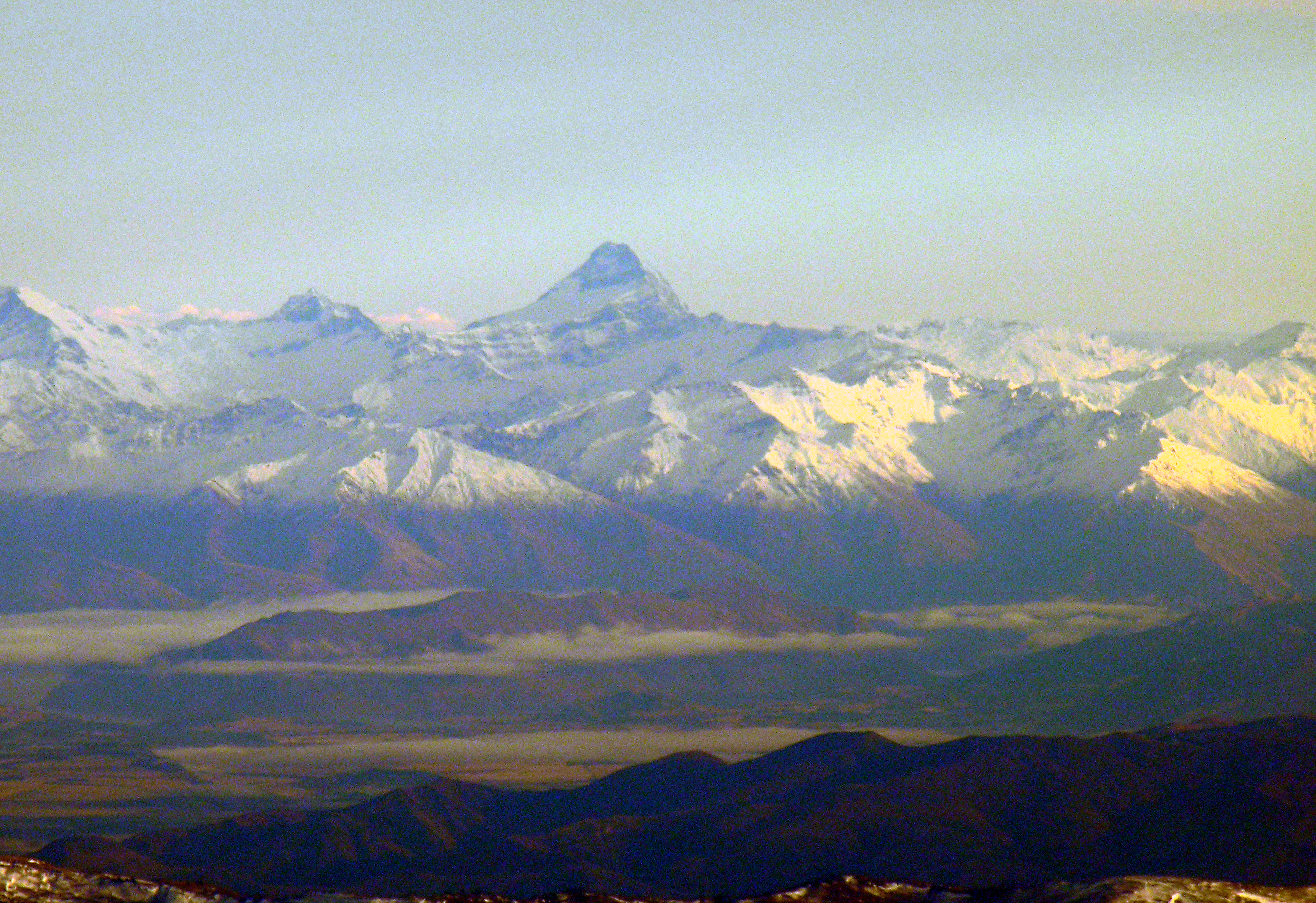
Tititea / Mount Aspiring 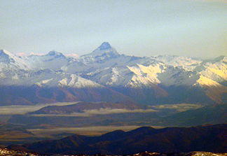
Der Gipfel des Tititea (Mitte)
Höhe 3.033 m Lage Queenstown-Lakes-Distrikt, Otago, Südinsel, Neuseeland Gebirge Neuseeländische Alpen Geographische Lage 44° 23′ 0″ S, 168° 44′ 0″ O-44.383333333333168.733333333333033Koordinaten: 44° 23′ 0″ S, 168° 44′ 0″ O 

Erstbesteigung 23. November 1909 durch Bernard Head mit Führern Jack Clarke und Alex Graham Normalweg über Bevan Col und Colin Todd Hut Der Tititea oder Mount Aspiring ist ein Berg in den Neuseeländischen Alpen auf der Südinsel Neuseelands. Mit einer Höhe von 3.033 Metern stellt er die höchste unumstrittene Erhebung auf neuseeländischem Staatsgebiet außerhalb des Aoraki-Massivs dar. Die Maori-Bezeichnung Tititea bedeutet „Glitzernder Gipfel“.
Auf den Berg können Klettertouren unternommen werden und im Winter bietet er ausgezeichnete Wintersportbedingungen. Ausgangspunkt für jegliche Aktivitäten in Bezug auf den Berg ist die nahe gelegene Ortschaft Wanaka. Seit 1964 wird das gesamte Gebiet durch den Mount-Aspiring-Nationalpark geschützt, der eine Fläche von 3.555 km² einnimmt und zusammen mit weiteren Schutzgebieten das von der UNESCO zum Weltnaturerbe erklärten als Te Wahipounamu bezeichnet wird. Der Tititea/Mount Aspiring lockt jedes Jahr viele Touristen an. Außerdem wurde der Berg für eine Szene für die Verfilmung der Der Herr der Ringe-Trilogie von Peter Jackson ausgewählt.
Weblink
- Alpinism & Ski - Mount Aspiring (englisch)
- Mount Aspiring auf An Encyclopaedia of New Zealand, 1966 (englisch)

Wikimedia Foundation.