Tobago Cays

Tobago Cays
Tobago Cays
Schrägluftbild mit Blickrichtung Südost, links im Vordergrund die Hauptinsel
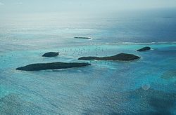
Petit Rameau
Schrägluftbild mit Blickrichtung Südost, links im Vordergrund die Hauptinsel
Petit Rameau
Gewässer Karibisches Meer
Archipel Grenadinen
Geographische Lage 12° 38′ N, 61° 22′ W12.635277777778-61.363055555556Koordinaten: 12° 38′ N, 61° 22′ W
Tobago Cays (St. Vincent und die Grenadinen)
Tobago Cays
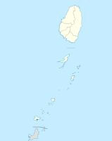
Anzahl der Inseln 5
Hauptinsel Petit Rameau
Gesamtfläche 13 ha
Einwohner (unbewohnt)
Tobago Cays, St. Vincent und die Grenadinen

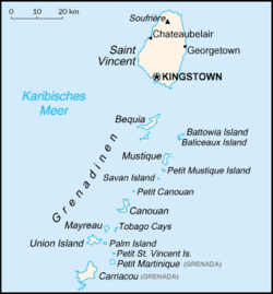
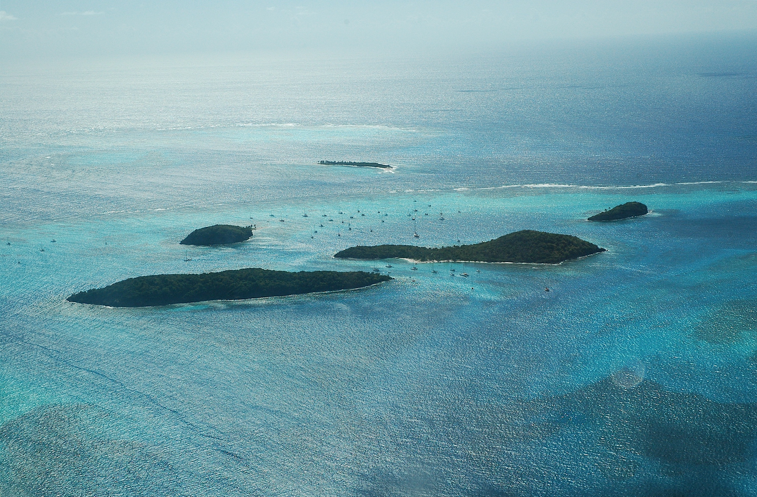
Die Tobago Cays sind eine Gruppe von fünf kleinen Inseln 2,2 km östlich der bewohnten Insel Mayreau. Als Teil der Inselkette der Grenadinen und gehören sie zum Staat St. Vincent und die Grenadinen in der Karibik. Geschützt werden die Inseln Petit Bateau, Baradel, Jamesby, die etwas südöstlich abgelegene Petit Tobac (Petit Tabac) und die rund sechs Hektar große Hauptinsel Petit Rameau durch das “Horse Shoe Reef”. Dieses große Korallenriff umgibt vier der Inseln wie ein hufeisenförmiger Schutzwall und hält die Atlantikdünung weitgehend ab. Alle fünf Inseln sind unbewohnt, auch wenn hier aufgrund der Segeltouristen viele sogenannte Boatboys arbeiten.

Die Tobago Cays sind ein beliebtes Ziel von Segelyachten und Tauchtouristen, die in der Lagune zwischen den Inselchen eine ideale Ankermöglichkeit und am nördlichen Horse Shoe Reef die Schönheit der karibischen Unterwasserwelt vorfinden.

Weblinks

Karte der Tobago Cays


Wikimedia Foundation.

Игры ⚽ Нужно решить контрольную?

Schlagen Sie auch in anderen Wörterbüchern nach:

  • Tobago Cays — are an archipelago comprised of five small uninhabited islands Petit Rameau, Petit Bateau, Baradol, Petit Tobac and Jamesby located in the Southern Grenadines. The Tobago Cays are now the key element of the Tobago Cays Marine Park, a national… …   Wikipedia

  • Tobago Cays — 12°38′N 61°21′W / 12.633, 61.35 …   Wikipédia en Français

  • Cays — ist Ortsname von Five Cays, Ort im Britischen Überseegebiet Turks und Caicosinseln Weiteres: Ambergris Cays, Gruppe der Caicosinseln Pedro Cays Gruppe der Pedro Bank, Jamaika Tobago Cays 4 kleine Inseln in St. Vincent und Grenadinen Siehe auch… …   Deutsch Wikipedia

  • Cayos de Tobago — Los Cayos de Tobago (en inglés: Tobago Cays) son un archipiélago integrado por cinco pequeñas islas deshabitadas ubicadas al sureste del mar Caribe; pertenecen administrativamente a San Vicente y las Granadinas y geográficamente al conjunto de… …   Wikipedia Español

  • List of islands in the Caribbean — This is a list of islands of the Caribbean region, organized by the political territory each island belongs to.Anguilla* Anguilla * Anguillita * Blowing Rock * Cove Cay * Crocus Cay * Deadman s Cay * Dog Island * East Cay * Little Island * Little …   Wikipedia

  • Union Island — is the southernmost island of the Grenadines belonging to the state of St. Vincent and the Grenadines It is situated 90 kilometers southwest of Barbados and the islands of Carriacou and the mainland of Grenada can be seen to the south.Clifton and …   Wikipedia

  • Antilles — Pour les articles homonymes, voir Antilles (homonymie). Antilles Carte des Antilles (en vert) dans la Caraïbe. Superficie …   Wikipédia en Français

  • Antillais — Antilles Pour les articles homonymes, voir Antilles (homonymie). Antilles …   Wikipédia en Français

  • Liste des îles des Antilles — Antilles Pour les articles homonymes, voir Antilles (homonymie). Antilles …   Wikipédia en Français

  • Saint Vincent And The Grenadines — Introduction Saint Vincent and the Grenadines Background: Disputed between France and the United Kingdom in the 18th century, Saint Vincent was ceded to the latter in 1783. Autonomy was granted in 1969, and independence in 1979. Geography Saint… …   Universalium

Share the article and excerpts

Direct link
Do a right-click on the link above
and select “Copy Link”