Traverse Gap

Traverse Gap
Die Traverse Gap, gesehen vom Lake Traverse (unten) nach Süden zum Big Stone Lake (oben).

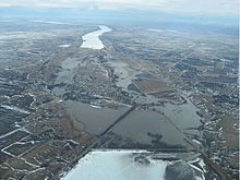
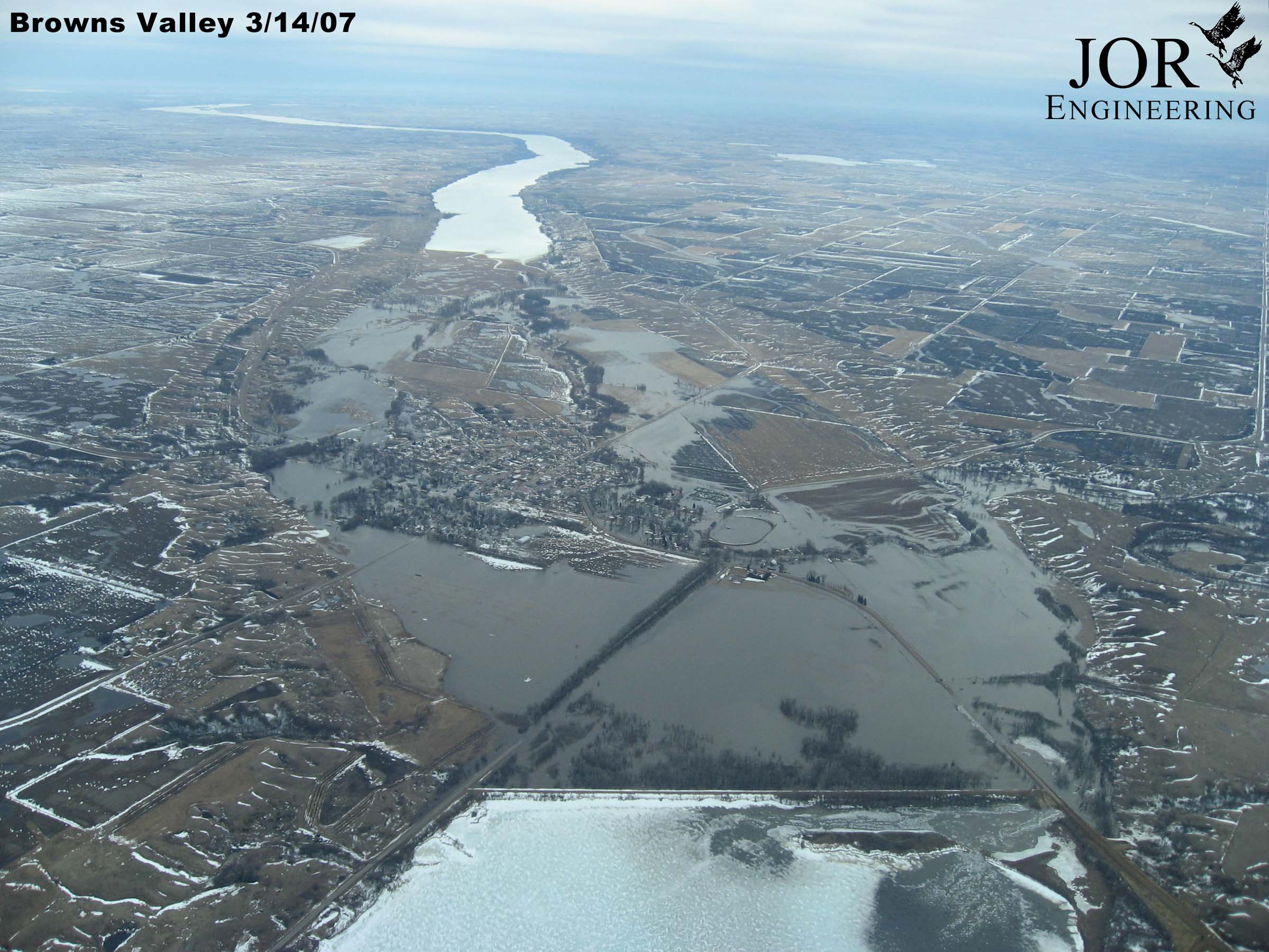
Die Traverse Gap ist ein trockengefallenes eiszeitliches Flussbett in Minnesota.

Es liegt an der Grenze der US-Bundesstaaten Minnesota und Süd-Dakota zwischen den Seen Lake Traverse und Big Stone Lake. Quer durch die Traverse Gap verläuft die Wasserscheide zwischen Atlantik und Artkischem Ozean. Eine Besonderheit ist, dass durch diese Kluft bei Überschwemmungen manchmal Wasser des einen Einzugsgebietes zu der jeweils anderen Seite abfließen konnte. Dies ist deshalb eine Besonderheit, weil kontinentale Wasserscheiden in der Regel durch Höhenlagen klar bestimmt sind und sich nur in geologischen Zeiträumen verschieben.

45.585-96.83

Wikimedia Foundation.

Игры ⚽ Поможем написать курсовую

Schlagen Sie auch in anderen Wörterbüchern nach:

  • Traverse Gap — [ Lake Traverse (top) and Big Stone Lake, cut through the Big Stone Moraine (NW to SE on this image).] The Traverse Gap is an ancient river channel occupied by Lake Traverse and Big Stone Lake and the valley connecting them at Browns Valley,… …   Wikipedia

  • Gap — Pour les articles homonymes, voir Gap (homonymie). 44° 33′ 34″ N 6° 04′ 43″ E …   Wikipédia en Français

  • traverse — I. noun Etymology: Middle English travers, from Anglo French travers (as in a travers, de travers across), from Latin transversum (as in in transversum set crosswise), neuter of transversus lying across; senses 5 9 in part from 2traverse more at… …   New Collegiate Dictionary

  • Lake Traverse — Bild gesucht  BW Geographische Lage Grenze Minnesota/South Dakota, USA …   Deutsch Wikipedia

  • Lake Traverse — Infobox lake lake name = Lake Traverse image lake = caption lake = image bathymetry = caption bathymetry = location = Minnesota and South Dakota coords = coord|45|41|18|N|96|44|15|W|region:US type:waterbody source:dewiki|display=inline,title type …   Wikipedia

  • Darién Gap — Coordinates: 7°54′N 77°28′W / 7.90°N 77.46°W / 7.90; 77.46 …   Wikipedia

  • Watford Gap — This article is about Watford Gap, a geographical location. For the larger town 80 km (50 mi) south, see Watford. For the nearby village, see Watford, Northamptonshire. Watford Gap: West Coast Main Line and M1 motorway in parallel The… …   Wikipedia

  • Central High School (Traverse City, Michigan) — seealso|Central High School for schools of the same name Traverse City Central High School is a public high school in Traverse City, Michigan, located at 1150 Milliken Drive. The principal is James Leyndyk.It is one of three high schools in… …   Wikipedia

  • Battle of the Argenta Gap — Infobox Military Conflict conflict=Battle of the Argenta Gap partof=World War II caption= Units of the 56th Recce moving through the gap date=1 April 19 April,1945 place= Italy casus= Allied advance north through Italy territory= Territory south… …   Wikipedia

  • Bataille de Hoover's Gap — Campagne de Tullahoma La Campagne de Tullahoma (Tullahoma Campaign en anglais, également appelée Middle Tennessee Campaign) est une série d affrontements entre l Armée de l Union et l Armée des États confédérés, au début de l année 1863, sur le… …   Wikipédia en Français

Share the article and excerpts

Direct link
Do a right-click on the link above
and select “Copy Link”