- Tubajon
-
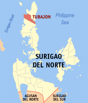
Municipality of Tubajon Lage von Tubajon in der Provinz Dinagat Islands 
Basisdaten Bezirk: Caraga Provinz: Dinagat Islands Barangays: 9 Distrikt: 1. Distrikt von Dinagat Islands PSGC: 168507000 Einkommensklasse: 4. Einkommensklasse Haushalte: 1391 Zensus 1. Mai 2000Einwohnerzahl: 7.815 Zensus 1. August 2007Koordinaten: 10° 18′ N, 125° 34′ O10.3125.56666666667Koordinaten: 10° 18′ N, 125° 34′ O Bürgermeister: Ronald O. Luib Geographische Lage auf den Philippinen 

Tubajon Tubajon ist eine philippinische Stadtgemeinde in der Provinz Dinagat Islands. Nach dem Zensus vom 1. Mai 2000 hat sie 6800 Einwohner in 1391 Haushalten.
Baranggays
Tubajon ist politisch in neun Baranggays unterteilt.
- Diaz (Romualdez)
- Imelda
- Mabini
- Malinao
- Navarro
- Roxas
- San Roque (Pob.)
- San Vicente
- Santa Cruz (Pob.)
Schlagen Sie auch in anderen Wörterbüchern nach:
Tubajon — Original name in latin Tubajon Name in other language State code PH Continent/City Asia/Manila longitude 10.33167 latitude 125.56194 altitude 108 Population 2906 Date 2011 07 31 … Cities with a population over 1000 database
Tubajon, Dinagat Islands — Tubajon is a 5th class municipality in the province of Dinagat Islands, Philippines. According to the 2000 census, it has a population of 6,800 people in 1,391 households.BarangaysTubajon is politically subdivided into 9 barangays.* Diaz… … Wikipedia
Dinagat Islands — This article is about the province. For the municipality, see Dinagat, Dinagat Islands. For the primary island of the province, see Dinagat Island. Dinagat Islands Province … Wikipedia
Dinagat Island — Lage der Provinz Dinagat Islands Dinagat Islands ist eine junge Provinz im Nordosten der Insel Mindanao auf den Philippinen. Die Provinz nimmt die gesamte Insel Dinagat ein und ist die fünfte Provinz des Bezirks Caraga, der Region XIII. Der Sitz… … Deutsch Wikipedia
Loreto (Dinagat Islands) — Municipality of Loreto Lage von Loreto in der Provinz Dinagat Islands Basisdaten Bezirk … Deutsch Wikipedia
Basilisa, Dinagat Islands — Map of Dinagat Islands showing the location of Basilisa Basilisa (also known as Rizal) is a municipality in the province of Dinagat Islands, Philippines. As of the 2007 census, it had a population of 31,363. The town became a part of the province … Wikipedia
Dinagat, Dinagat Islands — Dinagat redirects here. For the province where this municipality is administratively governed, see Dinagat Islands. For the primary island of the province, see Dinagat Island. Map of Dinagat Islands showing the location of Dinagat Dinagat is a… … Wikipedia
Laguindingan, Misamis Oriental — Laguindingan is a 5th class municipality in the province of Misamis Oriental, Philippines. According to the 2000 census, it has a population of 18,451 people in 3,968 households.The town will be the site of the Laguindingan International Airport … Wikipedia
List of cities and municipalities in the Philippines — This is a list of cities and municipalities in the Philippines arranged by province and in alphabetical order. As of 2006, there are 118 cities and 1509 municipalities.As of September 4, 2007, there are 136 cities, 1,495 municipalities, 81… … Wikipedia
List of ZIP Codes in the Philippines — In the Philippines, the Philippine ZIP code is used by the Philippine Postal Corporation (Philpost) to simplify the distribution of mail. While in function it is similar to the ZIP code used in the United States, its form and its usage is quite… … Wikipedia
Tubajon

18+
© Academic, 2000-2024
- Kontaktieren Sie uns: Unterstützung, Werbung
Wörterbücher Export, schritte mit PHP, Joomla, Drupal, WordPress, MODx.