U.S. Geological Survey

U.S. Geological Survey
United States Geological Survey

Offizielles Logo des US Geological Survey

Official identifier

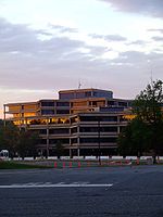
USGS-Hauptsitz in Reston (Virginia)

Gründung: 3. März 1879
Direktor: Mark Myers
Budget: $971 Millionen (2006)
Mitarbeiter: 10.000 (2004)

Die United States Geological Survey (kurz USGS, dt. Geologischer Dienst der Vereinigten Staaten) ist eine wissenschaftliche Behörde des US-Innenministeriums. Die Wissenschaftler des USGS untersuchen die Landschaften der USA, ihre Ressourcen und die Naturkatastrophen, die sie bedrohen.

Seit ihrer Gründung am 3. März 1879 ist die USGS eine unabhängige Forschungsorganisation ohne Regulierungsverantwortlichkeiten. Von 1962 an beteiligt sich die USGS sowohl an der Erforschung als auch der Erstellung von Karten der Erde, des Mondes und der Planeten.

Die USGS ist die einzige wissenschaftliche Behörde des US-Innenministeriums und beschäftigt in den USA circa 10.000 Menschen. Das Hauptquartier liegt in Reston (Virginia), weitere wichtige Büros existieren in Denver, Colorado und in Menlo Park, Kalifornien.

Die USGS ist das wichtigste Institut der USA für die amtliche Kartografie und ist bekannt für die Benutzung des Maßstabes 1:24.000. Dieses Kartenwerk heißt auf Englisch "7,5-minute topographic quadrangle series".

Die vier Hauptbetätigungsfelder sind:

Die USGS ist wie die NOAA Mitglied der Internationalen Charta für Weltraum und Naturkatastrophen.

Das Motto der USGS lautet "science for a changing world." (dt. Wissenschaft für eine sich verändernde Welt). Zu den am längsten laufenden Projekten der US Geological Survey gehören Untersuchungen an der San-Andreas-Verwerfung. Insbesondere Vermessungen im kalifornischen Örtchen Parkfield, das 1857 das Epizentrum des Fort Tejon-Erdbebens war, sollen dazu beitragen, die Vorhersage von Erdbeben zu verbessern.

Im Sommer 2006 beteiligte sich die Organisation zusammen mit der "Indian Directorate General of Hydrocarbons" (DGH) an der Erforschung von Gashydraten im Indischen Ozean.

Liste der Direktoren

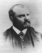
Clarence King, erster Direktor des USGS
  • 1879–1881 Clarence King
  • 1881–1894 John Wesley Powell
  • 1894–1907 Charles Doolittle Walcott
  • 1907–1930 George Otis Smith
  • 1930–1943 Walter Curran Mendenhall
  • 1943–1956 William Embry Wrather
  • 1956–1965 Thomas Brennan Nolan
  • 1965–1971 William Thomas Pecora
  • 1971–1978 Vincent Ellis McKelvey
  • 1978–1981 Henry William Menard
  • 1981–1993 Dallas Lynn Peck
  • 1994–1997 Gordon P. Eaton
  • 1998–2005 Charles G. Groat
  • seit 2006 Mark Myers

Weblinks


Wikimedia Foundation.

Игры ⚽ Поможем сделать НИР

Schlagen Sie auch in anderen Wörterbüchern nach:

  • Geological Survey of India — (GSI), established in 1851 is a government organization in India for conducting geological surveys and studies. It is one of the oldest of such organizations in the world.HistoryCurrently an organization under the control of the Union Ministry of …   Wikipedia

  • Geological survey — The term geological survey can be used to describe both the conduct of a survey for geological purposes and an institution holding geological information. A geological survey is the systematic investigation of the subsurface of a given piece of… …   Wikipedia

  • Geological Survey of South Australia — Der Geological Survey of South Australia, später auch Geological Survey Branch, war unter dieser Bezeichnung die geowissenschaftliche Behörde auf dem Territorium des heutigen australischen Bundesstaates South Australia. Dieser Aufgabenbereich… …   Deutsch Wikipedia

  • Geological Survey of Newfoundland and Labrador — Infobox Government agency agency name = Geological Survey of Newfoundland and Labrador nativename = nativename a = nativename r = logo width = 160px logo caption = seal width = seal caption = formed = 1864 jurisdiction = Government of… …   Wikipedia

  • Geological Survey of New South Wales — Der Geological Survey of New South Wales (Abk. GSNSW) ist die oberste staatliche Behörde auf dem Gebiet der Geowissenschaften im australischen Bundesstaat New South Wales. Das Hauptquartier befindet sich in Maitland und es werden weitere… …   Deutsch Wikipedia

  • Geological Survey of Belgium — The Geological Survey of Belgium (GSB) is a Belgian federal research institute for Belgian geology. It is a department of the Royal Belgian Institute of Natural Sciences. The institute is as a resource centre and project partner which produces… …   Wikipedia

  • Geological Survey of Canada — Infobox Government agency agency name = Geological Survey of Canada nativename = Commission Géologique du Canada nativename a = nativename r = logo width = 150px logo caption = seal width = seal caption = formed = 1842 jurisdiction = Government… …   Wikipedia

  • Geological Survey — United States Geological Survey …   Deutsch Wikipedia

  • Geological Survey of Victoria — Der Geological Survey of Victoria war unter dieser Bezeichnung die oberste geowissenschaftliche Behörde des australischen Bundesstaates Victoria. Durch die Fusion mit der Petroleum Branch des Ministeriums für Bergbau ging die Behörde in der neuen …   Deutsch Wikipedia

  • Geological Survey of Denmark and Greenland — Danmarks og Grønlands Geologiske Undersøgelse Established June 14, 1995 Activated June 14, 1995 …   Wikipedia

  • Geological Survey of Ireland — The Geological Survey of Ireland ( ga. Suirbhéireacht Gheolaíochta Éireann) was founded in 1845. It is part of the Department of Communications, Marine and Natural Resources. It is based in Beggars Bush Barracks in Dublin. Its multidisciplinary… …   Wikipedia

Share the article and excerpts

Direct link
Do a right-click on the link above
and select “Copy Link”