Utah State Route 128 — For the former highway, see Utah State Route 128 (1931–1933). State Route 128 Upper Colorado River Scenic Byway Dinosaur Diamond Prehistoric Highway … Wikipedia
Utah State Route 128 — Karte … Deutsch Wikipedia
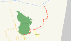
Utah State Route 313 — State Route 313 Dead Horse Point Mesa Scenic Byway … Wikipedia
Utah State Route 248 — Infobox road state=UT type=SR route=248 alternate name=Kearns Boulevard section=128 maint=UDOT length mi=14.481 length round=3 length ref=cite web | title=State Route 248 Highway reference | publisher=Utah Department of Transportation |… … Wikipedia
Utah State Route 279 — Infobox road state=UT type=SR route=279 alternate name=Potash Lower Colorado Scenic Byway section=133 maint=UDOT length mi=15.178 length ref=cite web url=http://www.dot.utah.gov/main/uconowner.gf?n=7140315032781325 title=Highway Description 00279 … Wikipedia
Utah State Route 224 — Infobox road state=UT type=SR route=224 section=128 maint=UDOT length mi=11.597 length round=3 length ref=cite web | title=State Route 224 Highway reference | publisher=Utah Department of Transportation |… … Wikipedia
Utah State Route 127 — Infobox road state=UT type=SR route=127 section=118 maint=UDOT length mi=2.507 length round=3 length ref=cite web | title=State Route 127 Highway reference | publisher=Utah Department of Transportation |… … Wikipedia
Utah State Route 226 — Infobox road state=UT type=SR route=226 section=128 maint=UDOT length mi=3.003 length round=3 length ref=Utah Department of Transportation, [http://www.udot.utah.gov/main/f?p=100:pg:2814615533739116:::1:T,V:814, Highway Reference Information] :… … Wikipedia
Utah State Route 225 — Infobox road state=UT type=SR route=225 alternate name=Park Lane section=128 maint=UDOT length mi=1.274 length round=3 length ref=cite web | title=State Route 225 Highway reference | publisher=Utah Department of Transportation |… … Wikipedia
Utah State Route 227 — Infobox road state=UT type=SR route=227 section=128 maint=UDOT length mi=0.704 length round=3 length ref=cite web | title=State Route 227 Highway reference | publisher=Utah Department of Transportation |… … Wikipedia

 US 191 nahe Moab
 I-70 nahe Cisco
