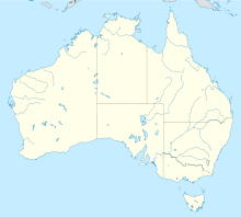
Williamstown (South Australia)
- Williamstown (South Australia)
-
Williamstown ist eine Stadt im Barossa Valley, South Australia, 51 Kilometer östlich von Adelaide.
Die Stadt liegt am südlichen Ende des Barossa Valley 310 Meter über dem Meeresspiegel. Heute leben etwa 2700 Menschen in Williamstown.
Williamstown gehört zum Barossa Council.
Geschichte
Vor der Besiedlung durch europäische Einwander lebte eine kleine Anzahl von Aborigines in dieser Gegend. Die ersten europäischen Entdecker kamen 1838 unter der Führung von Colonel William Light durch das Barossa Valley. Der erste Siedler in Williamstown war Thomas Adams, der den Ort Victoria Creek nannte. Das Land wurde für so wertlos gehalten, dass Adams es gegen eine Pferdeherde eintauschte. Der neue Besitzer, ein Mann namens Johnstone, teilte das Land in Parzellen auf. Er nannte die kleine Stadt nach seinem ältesten Sohn William und die Elizabeth Street nach seiner Frau. [2]
Einzelnachweise
- ↑ Australian Bureau of Statistics (25. Oktober 2007): Williamstown (Urban Centre/Locality) (Englisch). 2006 Census QuickStats. Abgerufen am 17. April 2009.
- ↑ The Sydney Morning Herald, 8. Februar 2004: Williamstown
Wikimedia Foundation.
Schlagen Sie auch in anderen Wörterbüchern nach:
Williamstown, South Australia — Infobox Australian Place | type = town name = Williamstown state = sa caption = lga = Barossa Council postcode = 5351 pop = 2,652 2006 Census [ [http://www.censusdata.abs.gov.au/ABSNavigation/prenav/LocationSearch?locationLastSearchTerm=williamsto… … Wikipedia
Kersbrook, South Australia — Infobox Australian Place | type = suburb name = Kersbrook state = sa caption = lga = Adelaide Hills Council postcode = 5231 pop = propval = $345,000 (Q1 2006) [ [http://www.reisa.com.au Real Estate Institute of South Australia] ] est = 1850s… … Wikipedia
Nuriootpa, South Australia — Nuriootpa South Australia Memorial hall … Wikipedia
Moculta, South Australia — … Wikipedia
Birdwood (South Australia) — Birdwood Das Gebäude der Mehlmühle Blumberg (heute National Motor Museum) an der Hauptstraße von Birdwood Staat … Deutsch Wikipedia
Forreston, South Australia — Infobox Australian Place | type = town name = Forreston state = sa caption = lga = Adelaide Hills Council postcode = 5233 pop = est = 1850 stategov = Schubert fedgov = Mayo dist1 = 41 location1= Adelaide dist2 = 3 location2= GumerachaForreston is … Wikipedia
Birdwood, South Australia — Infobox Australian Place | type = town name = Birdwood state = sa caption = The old mill building at the National Motor Museum on Birdwood s main street. lga = Adelaide Hills Council postcode = 5234 pop = 1,127 (2006 Census) Census 2006 AUS… … Wikipedia
Williamstown — or Williamtown is the name of several places in the world:;Australia *Williamtown, New South Wales **RAAF Base Williamtown, New South Wales *Williamstown, South Australia *Williamstown, Victoria **Williamstown railway line, Melbourne… … Wikipedia
Gorge Road, South Australia — This article is about Gorge Road in Adelaide, South Australia. For Gorge Road in New Zealand, see Gorge Road. Gorge Road Little Para Road South Para Road Lyndoch Valley Road … Wikipedia
Mount Pleasant, South Australia — Mount Pleasant Population: 593 2006 Census [1] Established: 1843 Postcode … Wikipedia
 Australien
 South Australia
