Ystradfellte

Ystradfellte
51.8095-3.5535
Ystradfellte (Vereinigtes Königreich)
Ystradfellte
Ystradfellte

Ystradfellte (Walisisch: Tal des Mellte-Flusses) ist ein Dorf im walisischen Brecon-Beacons-Nationalpark. Es gehört zur Unitary Authority Powys.

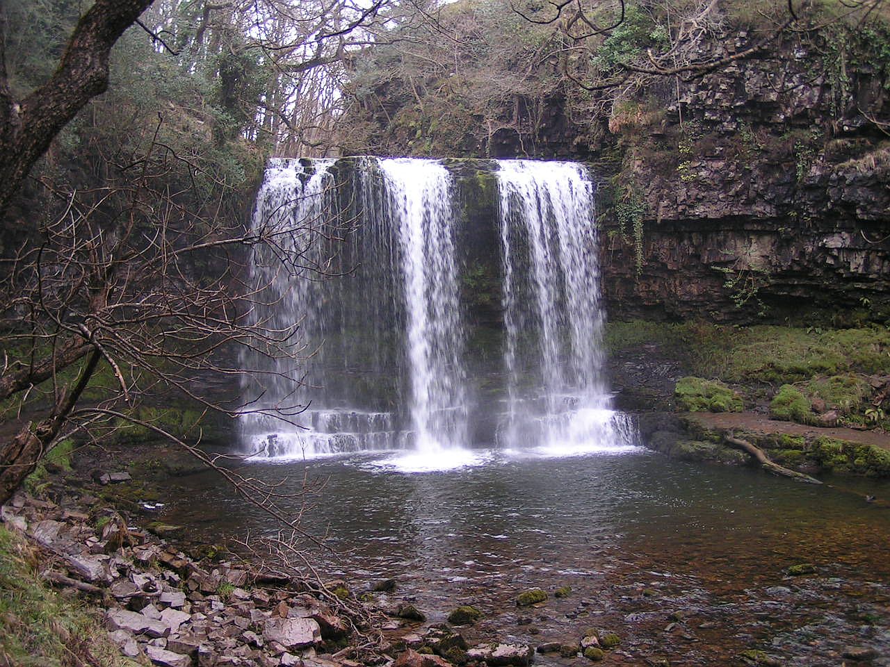
Der Ort ist vor allem bekannt für seine Karstlandschaft und seine Wasserfälle.

Weblinks

Wasserfall Sgwd yr Eira

Wikimedia Foundation.

Игры ⚽ Поможем написать реферат

Schlagen Sie auch in anderen Wörterbüchern nach:

  • Ystradfellte — Infobox UK place latitude = 51.80894 longitude = 3.55487 country = Wales official name = Ystradfellte welsh name = Ystradfellte unitary wales = Powys lieutenancy wales = Powys constituency westminster = Brecon Radnorshire post town = postcode… …   Wikipedia

  • Barbara Brooke, Baroness Brooke of Ystradfellte — Barbara Muriel Brooke, Baroness Brooke of Ystradfellte and Baroness Brooke of Cumnor DBE (14 January 1908 ndash;1 September 2000) was a British Conservative politician.Brooke was the youngest of five children of Welsh minister, Rev. Alfred… …   Wikipedia

  • Brecon Beacons National Park — Pen y Fan Der Brecon Beacons Nationalpark ist ein Nationalpark in Südwales mit einer Fläche von 1.344 km². Seinen Kern bilden die Brecon Beacons. Inhaltsverzeichnis 1 Geschichte …   Deutsch Wikipedia

  • Porth yr Ogof — Infobox Cave name = Porth yr Ogof photo = caption = location = near Ystradfellte depth = length = convert|2.25|km|mi|1|lk=on coordinates = survey = survey electronic format = (which cave software is it in) discovery = geology = limestone number… …   Wikipedia

  • Brecon-Beacons-Nationalpark — Pen y Fan …   Deutsch Wikipedia

  • Brecon Beacons — Geobox|Protected Area name = Brecon Beacons native name = other name = other name1 = category local = National Park of Wales category iucn = V image size = image caption = Part of the Brecon Beacons, looking from the highest point Pen y Fan, 886… …   Wikipedia

  • Machynlleth — Coordinates: 52°35′27″N 3°50′56″W / 52.59087°N 3.84887°W / 52.59087; 3.84887 …   Wikipedia

  • New Radnor — For the former parliamentary constituency, see New Radnor (UK Parliament constituency). Coordinates: 52°14′N 3°10′W / 52.24°N 3.16°W / 52.24; 3.16 …   Wikipedia

  • Montgomery, Powys — Coordinates: 52°33′46″N 3°08′57″W / 52.5628°N 3.1493°W / 52.5628; 3.1493 …   Wikipedia

  • Crickhowell — Coordinates: 51°51′35″N 3°08′14″W / 51.8597°N 3.1372°W / 51.8597; 3.1372 …   Wikipedia

Share the article and excerpts

Direct link
Do a right-click on the link above
and select “Copy Link”